
Ketchikan - Shelter Cove Road
Alternatives Considered
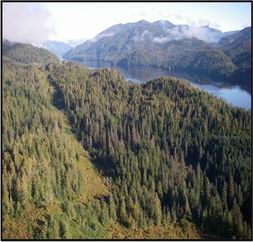
After field reconnaissance and review of the preliminary geotechnical information, DOT&PF considered the No-Build Alternative and four other alternatives with different combinations of alignments. High refers to a more northerly route whereas Low is more southerly. Generally the High route encounters higher elevations than the Low route. Please refer to Figure 2: Alternatives Location Map.
- No-Build
- Alternative I- High Road Corridor
- Alternative II and II (A) - Low Road Corridor
- Alternative III- High-Low Corridor
- Alternative IV and IV (A) - Low-High Corridor
No-Build Alternative
The No-Build Alternative would construct nothing to link the Lake Harriet Hunt area with Shelter Cove. The roads in the area would remain the same with their present configuration and ownership.
Alternative I – High – High Road Corridor
This corridor generally follows the USFS Section 4407 reciprocal easement. This is a northerly, upland route from Lake Harriet Hunt to Leask Lake. Beyond Leask Lake the road bears to the northeast then turns southeast to join the existing Shelter Cove Road.
Alternative II and II (A) - Low – Low Road Corridor
This corridor follows either the White River Road or would use a variation around the north of Lake Harriet Hunt to connect with existing logging roads in the Mental Health Trust, and then follows the shore of George Inlet to the Salt Lagoon, then northerly to where it joins the existing Shelter Cove Road
Alternative III- High - Low Corridor
This corridor follows the Section 4407 reciprocal easement to Leask Lake similar to Alternative I, then drops down to the shore of George Inlet at Leask Cove. From there, it follows the Low Road corridor to the Shelter Cove Road
Alternative IV and IV (A) - Low - High Corridor
This corridor follows either the White River Road or the variation around Lake Harriet Hunt to Leask Cove where it turns northerly to connect with the Section 4407 reciprocal easement east of Leask Lake then turns southeasterly to join with the existing Shelter Cove Road.