
Gravina Access Project Maps & Photos 
Note: All previous maps, diagrams and photos, including an overview of the Selected Alternative from the 2004 FEIS, are archived on the Project documents page.
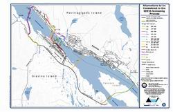
Click on the map below for a larger PDF version of Alternatives to be Considered in the SDEIS Screening Process.
Click on the map below for a larger PDF version of Reasonable Alternatives Evaluated in the
FEIS and Recent Gravina Island Developments.
![]()