Dalton Highway
Livengood to Deadhorse
The Dalton Highway, also called the Haul Road, is one of the northern-most roads in the world. It was originally constructed by Alyeska Pipeline Service Company to support the development of the Trans-Alaska Pipeline and to service the oil fields on Alaska’s North Slope. It is now owned and maintained by the State of Alaska and is open to the public year-round.

Before you drive...
The first thing to know about the Dalton Highway is that this is not your average highway! If you are planning on driving this road as a tourist, please keep in mind that driving conditions are difficult throughout the year and services are extremely limited. Making this trip requires driving a vehicle capable of handling difficult conditions and bringing extra fuel, water, food, first aid supplies, spare tires, appropriate clothing, and other emergency gear. Guided tours are available and are a great and safe way to make this trip. The vast majority of traffic on the Dalton is comprised of commercial vehicles bound for the North Slope oil fields delivering fuel, supplies, equipment, and other goods to support commercial activity. Before you head out on a trip to the Arctic Circle or all the way to Deadhorse, please check out the traveler information links on the side bar.
Thinking about driving in the winter? You will need to do your research and make sure you are fully prepared if you plan to travel in the winter months. Winter conditions can last from early August all the way through June. The Dalton has even seen snow in July! Avalanches in Atigun Pass are a common occurrence and have left drivers stranded for days. Some areas see such heavy snow drifts that huge semi-trucks are unable to pass through. Most drivers communicate with CB radios, which is an essential addition to your vehicle on a winter trip. Like we said before, this is no average highway and you must be prepared to stay safe.
Highway overview
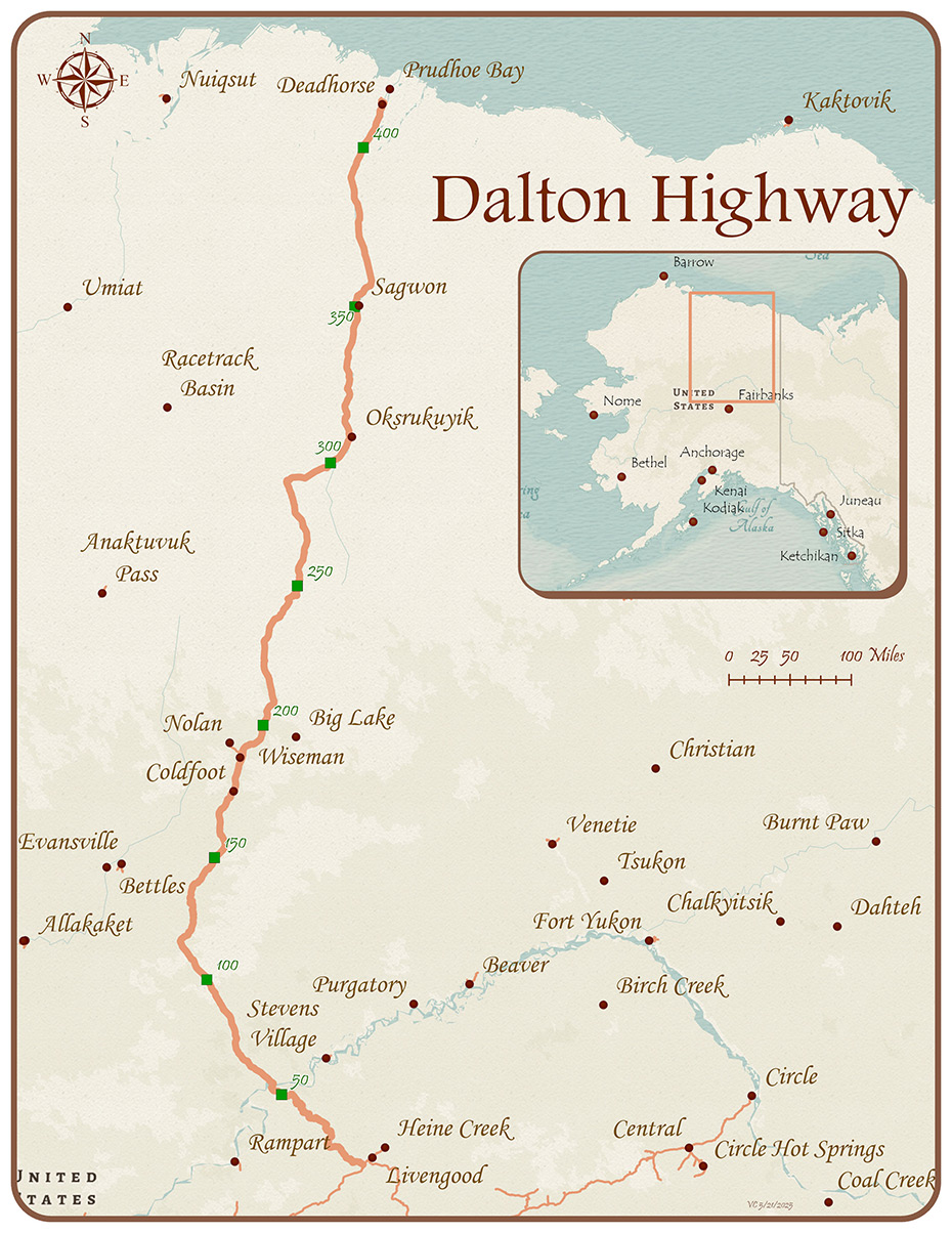
The Dalton Highway runs for 414 miles from Livengood, a small community 80 miles north of Fairbanks, to Deadhorse on the shores of the Arctic Ocean. The terrain starts with boreal forest, runs over the 4800-foot Atigun Pass in the Brooks Mountain Range, turns into the Arctic Foothills, and finally ends with about 55 miles of arctic coastal plain tundra. Commercial truck traffic delivering supplies and fuel to the North Slope oil fields accounts for the majority of the traffic, although tourist traffic, including motorcyclists and cyclists, has been increasing steadily since the highway was opened to the public in 1994.

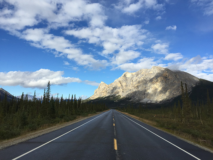
View of Mount Sukakpak, twenty miles north of Coldfoot on the Dalton Highway. Photo by Jake Allen, Alaska DOT&PF
Drivers can expect mostly gravel and dirt surfaces with intermittent pavement. The driving surface is rough is the summer and winter, so it’s important to drive a vehicle properly equipped for remote travel. Many rental car companies prohibit renters from driving their vehicles up the Dalton Highway, so be sure to check before you drive a rental car up this road.
How is the highway maintained?
Alaska DOT&PF operates seven year-round maintenance camps along the Dalton Highway corridor. Each camp is open seven days per week from 6 a.m. to 5:30 p.m. and has an average of two to three operators working at a time. Each maintenance station covers about 60-70 miles of road. Current road condition information for this route and others around the state can be found through our 511 Traveler Information system.
For detailed maintenance information, please visit our Dalton Highway Maintenance page. For information about construction projects that will improve safety and road conditions, visit our Construction on the Dalton Highway page.
Dalton Highway History
The first road intended for motorized vehicles that traversed the Arctic landscape was known as the Hickel Highway. It was the first attempt to provide road access the newly-discovered oil resources on the North Slope. This first road, which opened in 1968, brought the first supplies to the Prudhoe Bay oil fields and allowed for construction of the first permanent facilities. This road, however, was farther to the west than the route planned for the Trans Alaska Pipeline, and without maintenance, it was eventually abandoned.
The following excerpts about the road that eventually became the Dalton Highway come from the booklet Historic Roads of Alaska: Driving the History of the Last Frontier published in 2017 by Alaska DOT&PF and other state agencies with funding from the Federal Highway Administration. You can download a PDF copy of the booklet here to read the full chapter on the Dalton Highway and learn about the history of other Alaska roads. You can also hear some first-person accounts related to Dalton Highway history at the Project Jukebox website, part of the Oral History Program at the University of Alaska Fairbanks .
From chapter 9 of Historic Roads of Alaska: Driving the History of the Last Frontier:
The oil companies needed a route to access their facilities at Deadhorse on the North Slope and to perform maintenance on the pipeline. So the Alyeska Pipeline Service Company built the first version of the Dalton Highway, known simply as the haul road, starting with the stretch from Livengood to the Yukon River in 1969. This road was focused entirely on the private oil industry needs, although Alyeska agreed to build it to state secondary-road design requirements.
However, the plan to quickly build the pipeline ran into obstacles. First, Native land claims needed to be settled, through the Alaska Native Claims Settlement Act in 1971. Not long after, a group of environmental organizations sued the federal government over the pipeline’s permits – including the right-of-way for building the haul road along the pipeline route – and over the environmental review process. In 1973 the courts sided with the environmental groups, leading Congress to pass the Alaska Pipeline Authorization Act to resolve the permitting issues. These delays meant that it was not until 1974 that Alyeska began construction on the pipeline and the majority of the haul road. The road was needed first, and over five months in the summer of 1974, 390 miles of road were built.

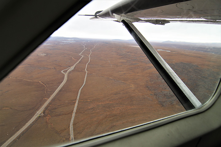
From the passenger seat of a small commuter plane, the Dalton Highway and the Trans Alaska Pipeline are seen running side-by-side north of Atigun Pass. Photo by Caitlin Frye, Alaska DOT&PF
For the next three years, the haul road was the scene of nearly constant travel and activity up and down its route. Alyeska and its contractors spared nearly no expense building the pipeline, since every day that the oil remained in the north was a day’s sale on the markets lost. That rush meant jobs were plentiful and pay was very good, including for the truckers who moved most of the material to the many pipeline construction camps north of Fairbanks. It wasn’t uncommon for Teamsters to earn between $7,000 and $10,000 per month [$35,000 to $50,000 in 2017]. Because of the difficult road conditions and likelihood of bad weather, the Teamster contract guaranteed eighteen-hour days, which could translate to a trucker earning $80,000 [$395,000] in a year, working nine or ten months.
That good money could come at a cost. Like the Hickel Highway, driving the haul road in its first years was no easy task. Although it was built to higher standards than its predecessor, it still had many dangerous spots, especially going over the Brooks Range. As well, many truckers were from outside Alaska, and didn’t have the experience driving in its unique conditions. As one Alaskan trucker said, “You'd be surprised at the older drivers that have been around a long time, driving everywhere in the country, come up here and thought there's nothing to this. The next thing you know, they are in the ditch, upside down or maybe dead.” Nor were things easy for local drivers. That same trucker described hauling the eighty-foot pipes that made up the pipeline: “It was a good way for a truck driver with a good record to blow his reputation in one trip. [The trailer] had a mind of its own…. It turned on its own.”
Alyeska finished the pipeline in 1977, and on June 20th oil started flowing from Deadhorse to Valdez. The company still needed the haul road for maintenance and transportation, but it no longer needed to control it. In 1979, the company turned over what Alyeska’s president called a “gift to the state.” Two years later, the state opened the newly named James W. Dalton Highway to public traffic up to Disaster Creek at MP 211. The whole road opened to the public in 1994, drawing a new flock of travelers to the North Slope.

