Damalanche
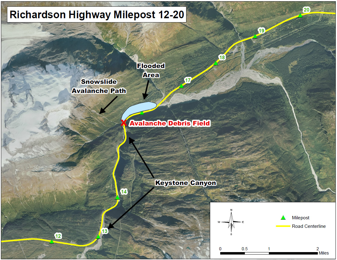
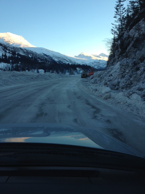
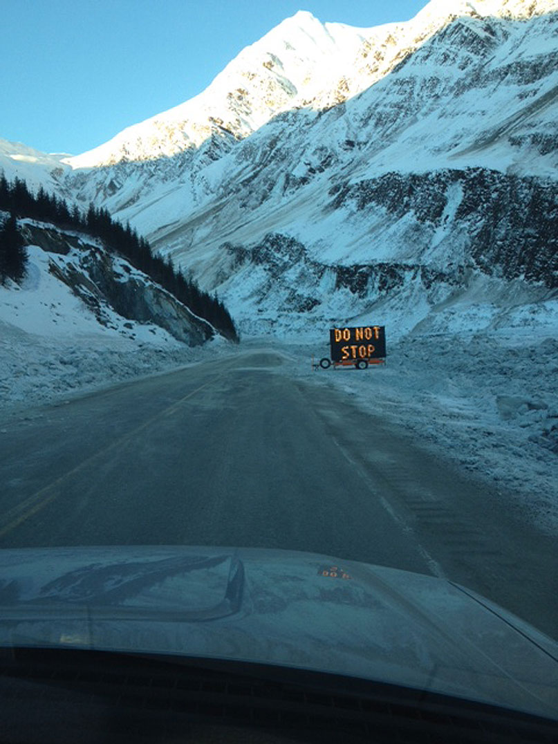
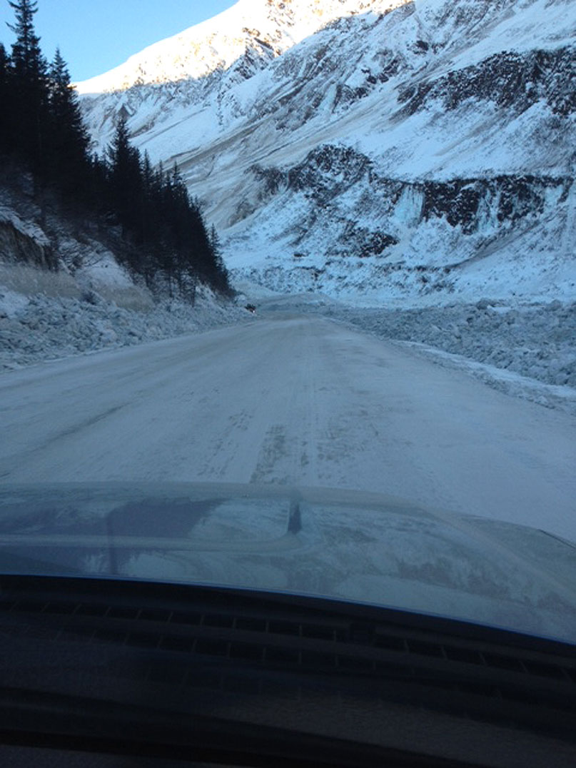
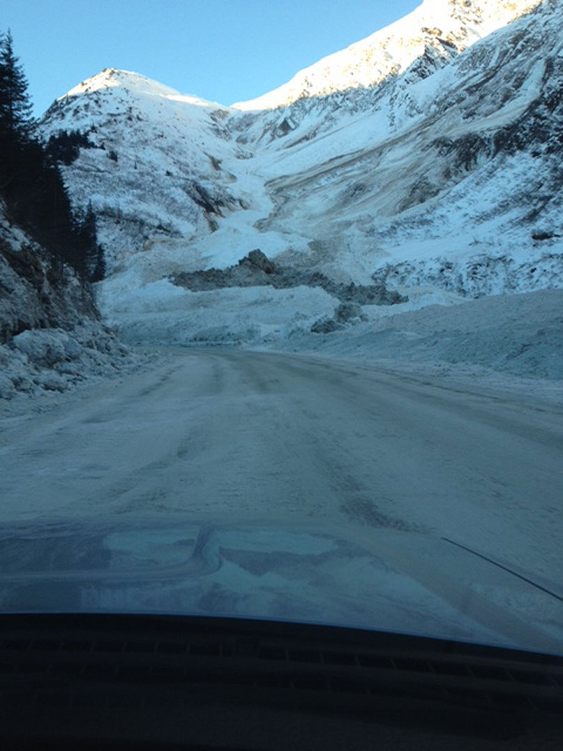
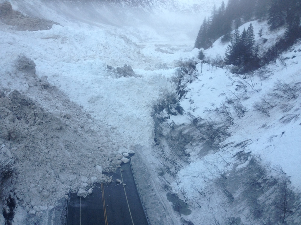
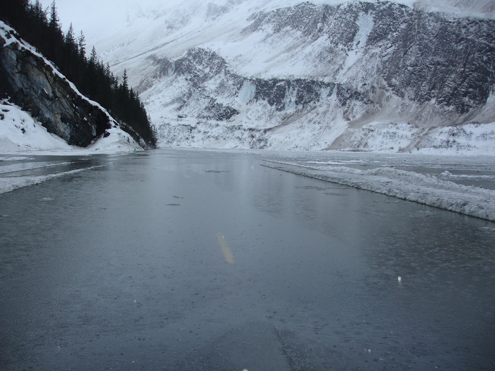
On January 24, 2014, after nearly 12 inches of rain and abnormally high temperatures that week, the snow around Thompson Pass began to shed, resulting in a series of both large and small avalanches. The avalanches blocked the Richardson Highway near the end of Keystone Canyon, cutting off ground access to Valdez. Luckily, no one was injured in the early morning slides.
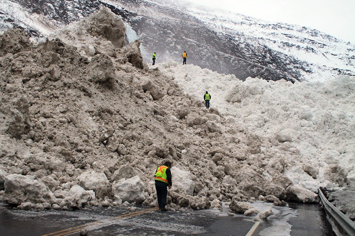
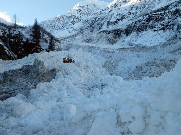
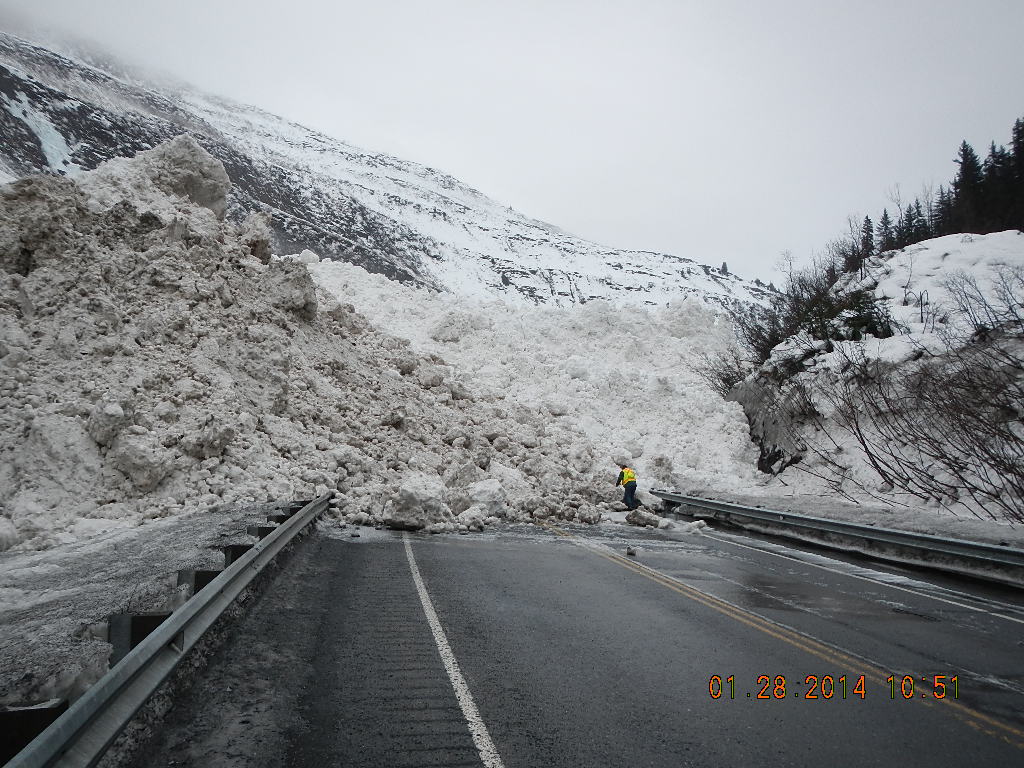
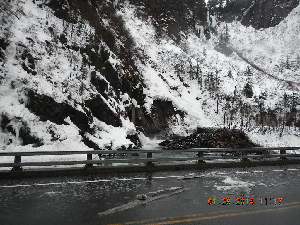
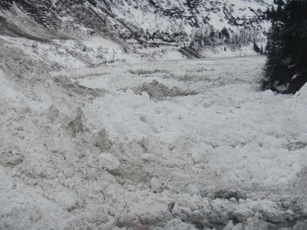
Maintenance staff inspect the avalanche debris at Snowslide Gulch, Richardson Highway mile 16, on January 28, 2014. Photo by Robert Dunning, DOT&PF
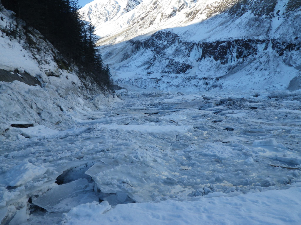
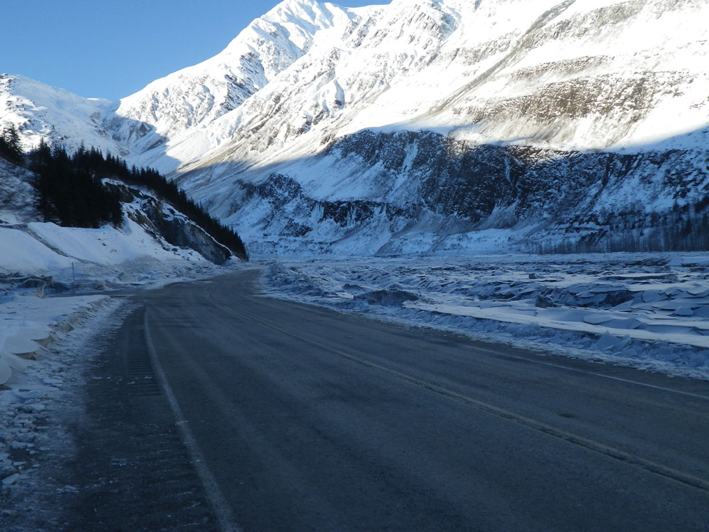
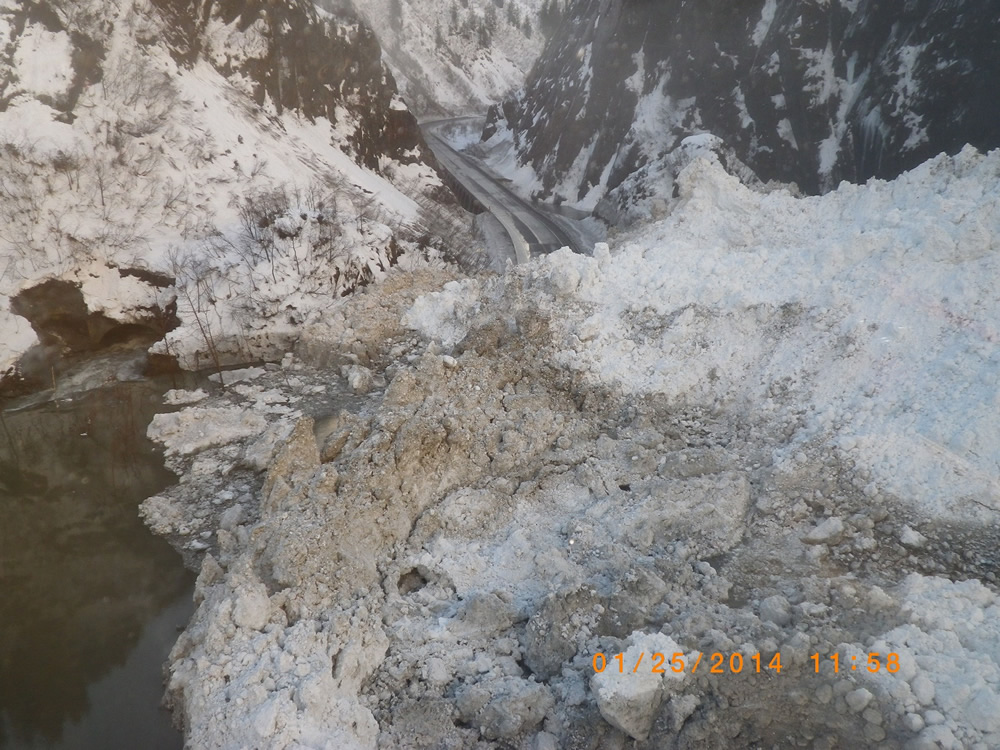
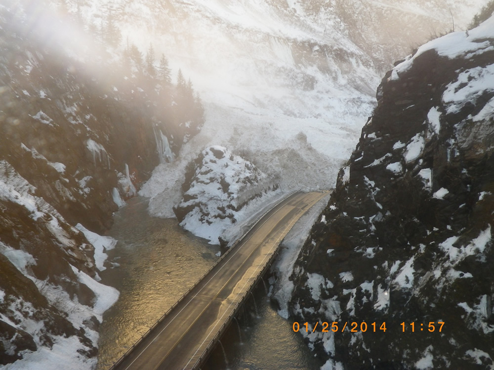
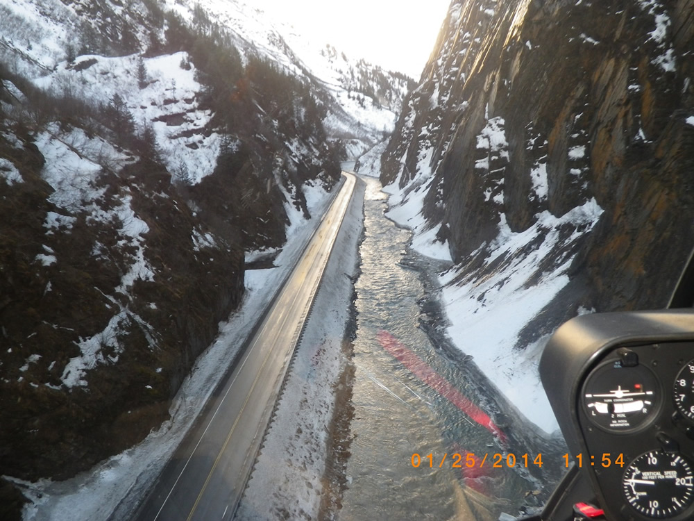
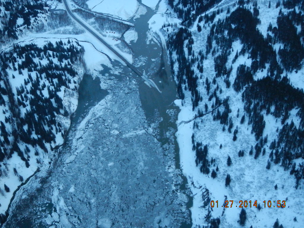
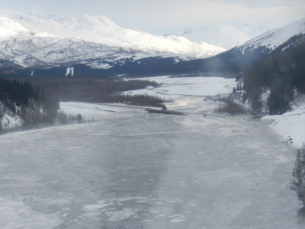
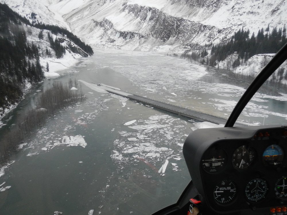
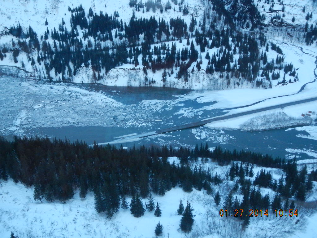
This epic slide also dammed the Lowe River, submerging a large section of the Richardson Highway under a lake 30 feet deep, half-a-mile long, and ultimately containing an estimated one billion gallons of water. The blockage was dubbed the “damalanche” by locals, as it was both a dam and an avalanche.
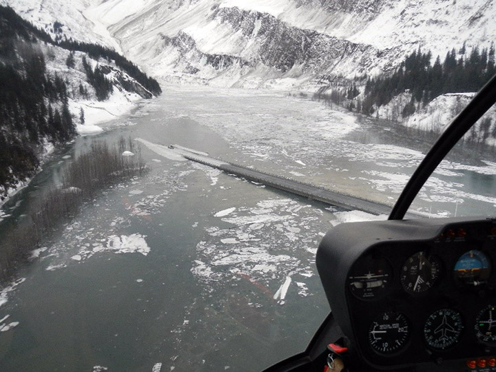
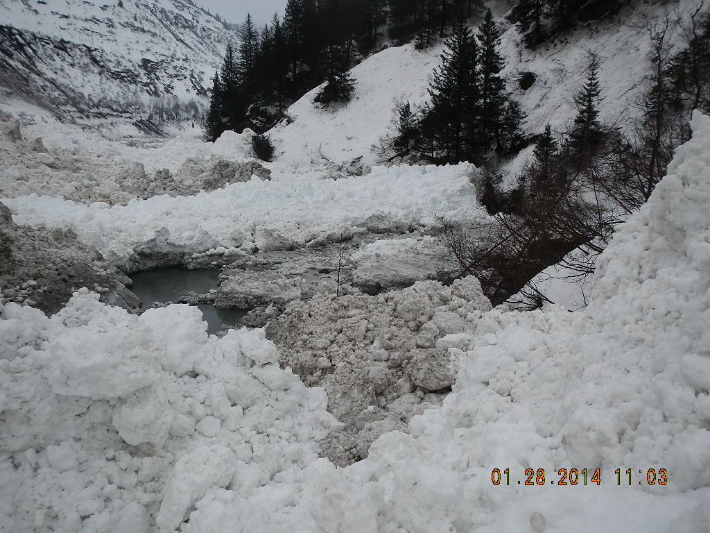
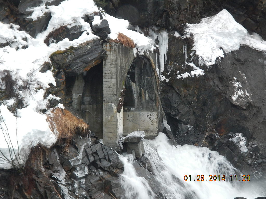
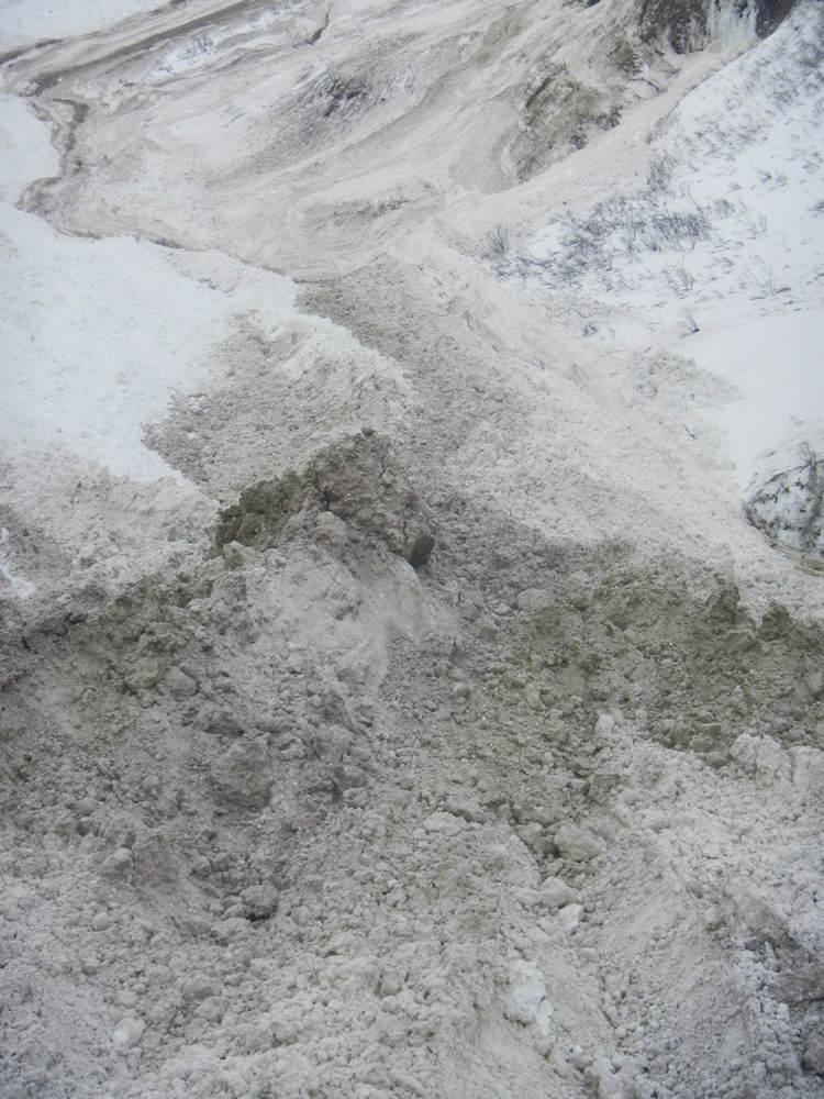
Snowslide Gulch at mile 16 on the Richardson Highway, north side of damalanche on January 28, 2014. Photo by Robert Dunning, Alaska DOT&PF
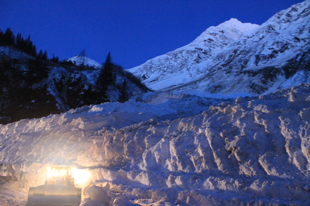
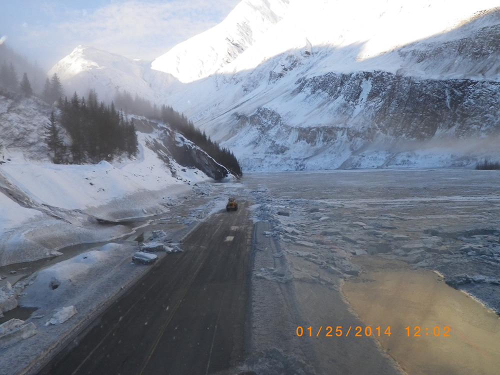
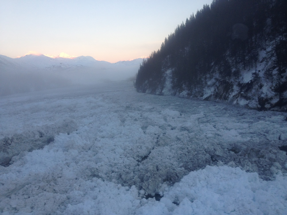
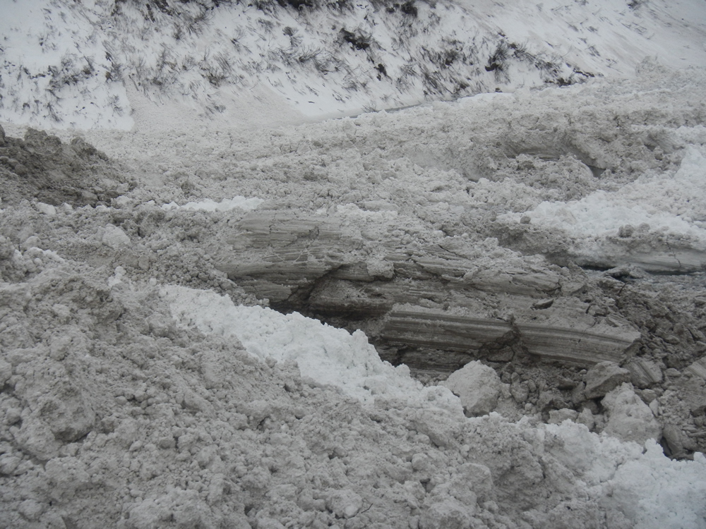
Alaska DOT&PF maintenance forces are well-seasoned in cleaning up after big events, including avalanches. But damalanche was something else entirely. Several thousand feet of the highway was covered in snow that was as high as four telephone poles stacked on top of each other.
Maintenance crews were not able to start clearing the avalanche debris right away. The massive lake prevented crews from accessing the snow from the north, and the snow from the south was holding the water in place, so it could not be removed either. It took a week for the water to find its way back to its river channel before crews could begin debris removal work.
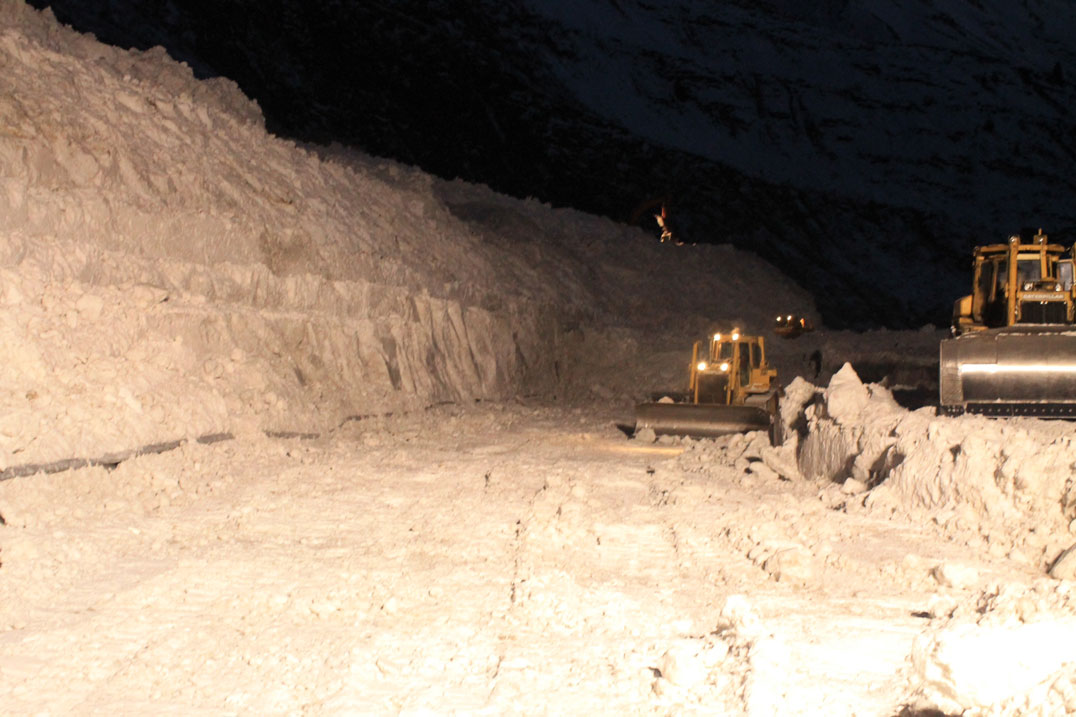
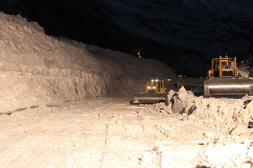
Richardson Highway damalanche cleanup, January 2014. Photo by Alaska DOT&PF staff
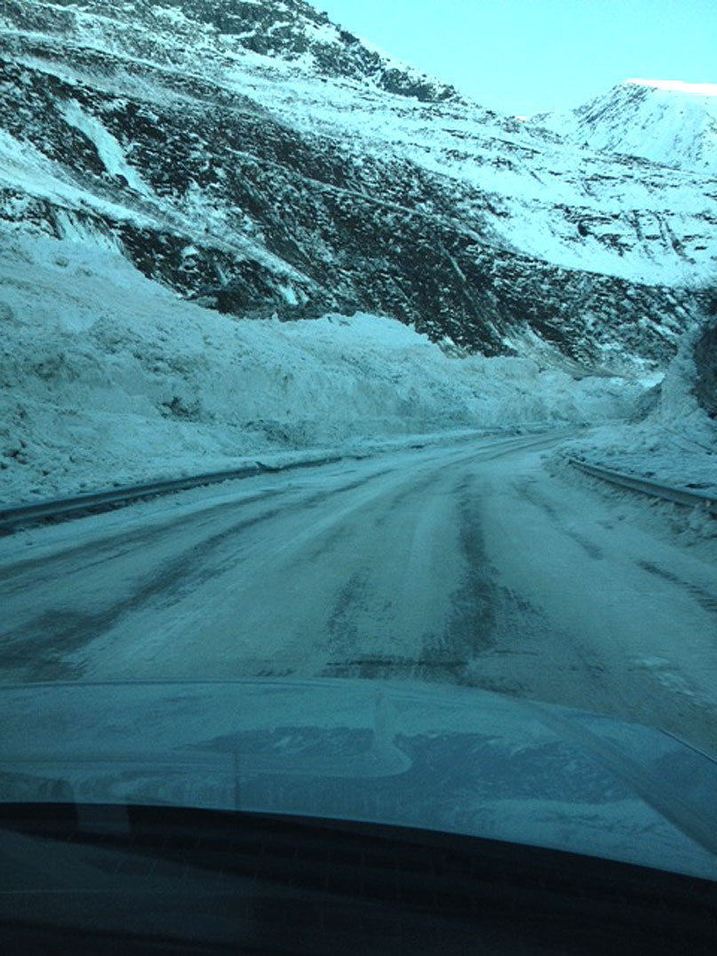
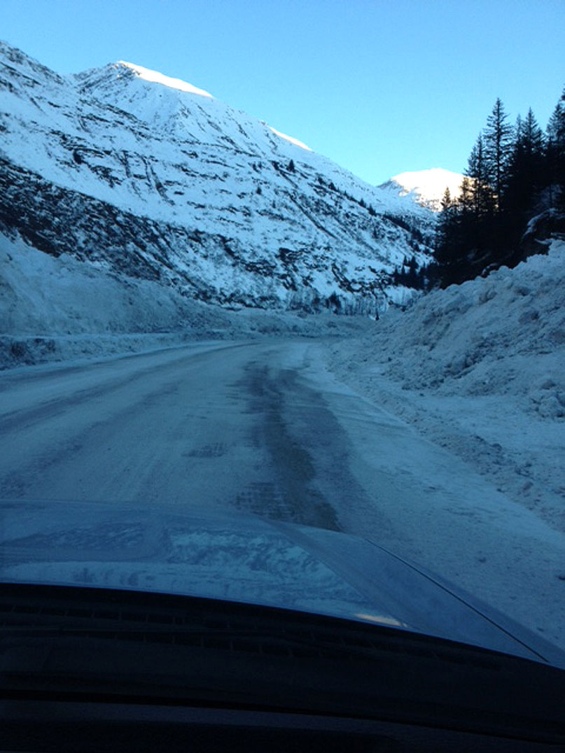
DOT&PF brought in staff from around the state, as well as local contractors, to remove the 200,000 cubic yards of snow, working 24 hours a day for five days. Work started from the top of the snow pile as workers used heavy equipment to move the snow down before it could be pushed aside and removed from the highway. When all the snow and debris was removed, the highway saw little more damage than some guardrail that needed to be replaced.
Watch the video below for some amazing footage and stories from this epic event.
More Resources
Photos taken February 5, 2014 (Click image for full size image for download)

Avalanche debris at Keystone Canyon has been cleared and the highway is now open for all traffic. Photo by Alaska DOT&PF staff
Avalanche debris at Keystone Canyon has been cleared and the highway is now open for all traffic. Photo by Alaska DOT&PF staff
Avalanche debris at Keystone Canyon has been cleared and the highway is now open for all traffic. Photo by Alaska DOT&PF staff
Avalanche debris at Keystone Canyon has been cleared and the highway is now open for all traffic. Photo by Alaska DOT&PF staff
Avalanche debris at Keystone Canyon has been cleared and the highway is now open for all traffic. Photo by Alaska DOT&PF staff
Avalanche debris at Keystone Canyon has been cleared and the highway is now open for all traffic. Photo by Alaska DOT&PF staff
Avalanche debris at Keystone Canyon has been cleared and the highway is now open for all traffic. Photo by Alaska DOT&PF staff
Avalanche debris at Keystone Canyon has been cleared and the highway is now open for all traffic. Photo by Alaska DOT&PF staff
Photos - 2/3/14 (Click image for full size image for download)
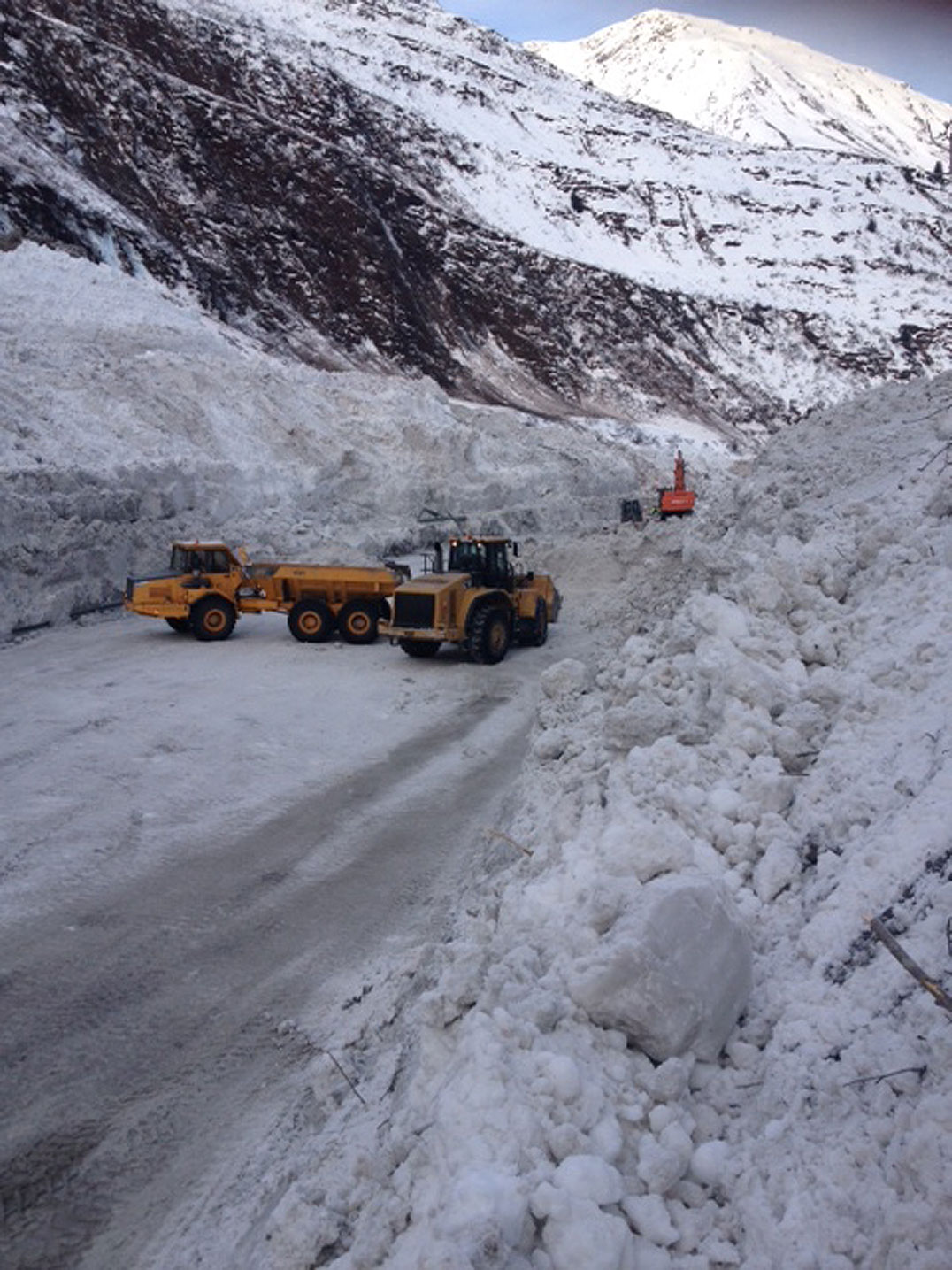
Photo by Alaska DOT&PF staff
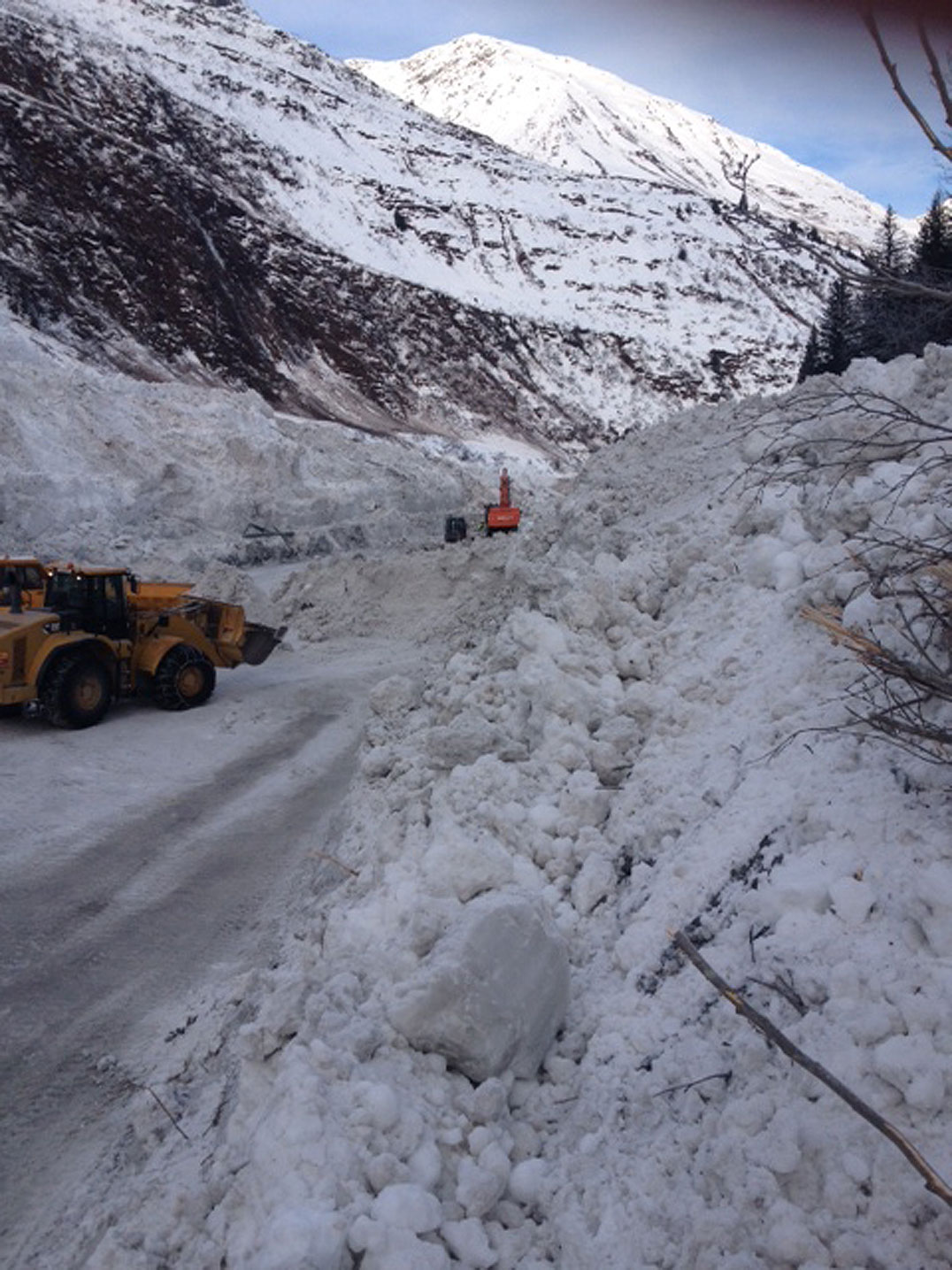
Photo by Alaska DOT&PF staff

Photo by Alaska DOT&PF staff
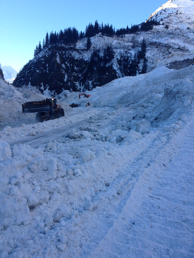
Photo by Alaska DOT&PF staff
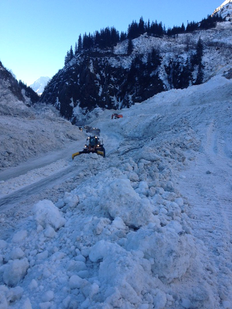
Photo by Alaska DOT&PF staff
Photo by Alaska DOT&PF staff
Photos - 2/2/14 (Click image for full size image for download)

Photos - 2/1/14 (Click image for full size image for download)


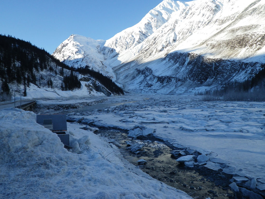
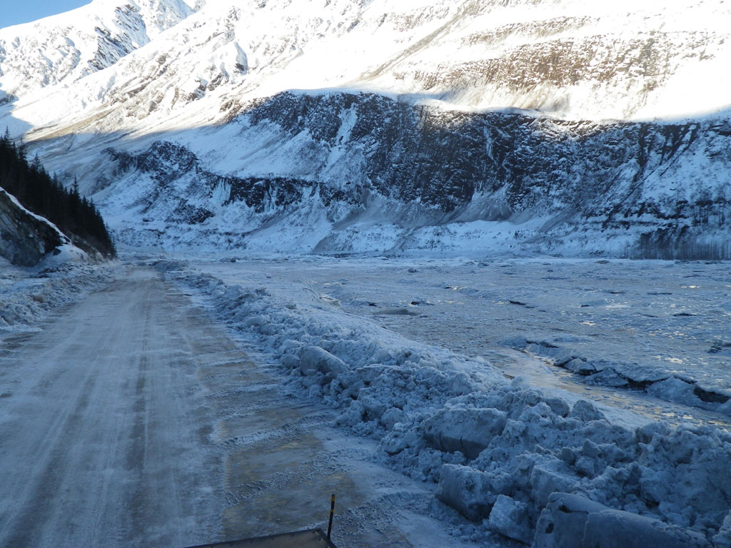
Photos - 1/31/14 (Click image for full size image for download)
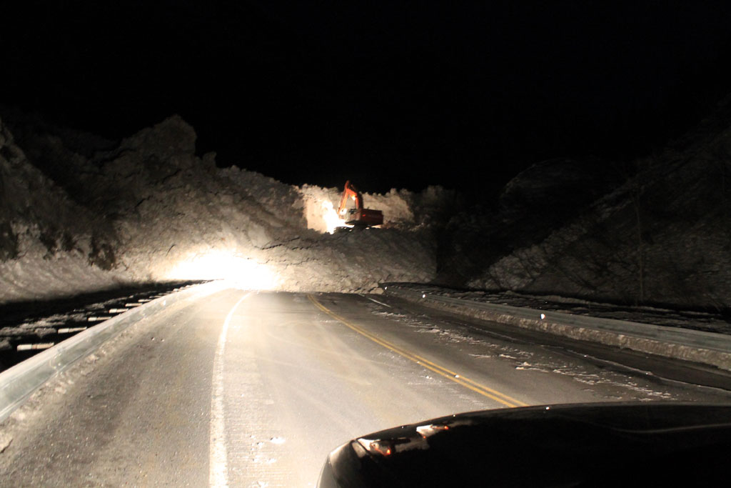

Photo by Alaska DOT&PF staff
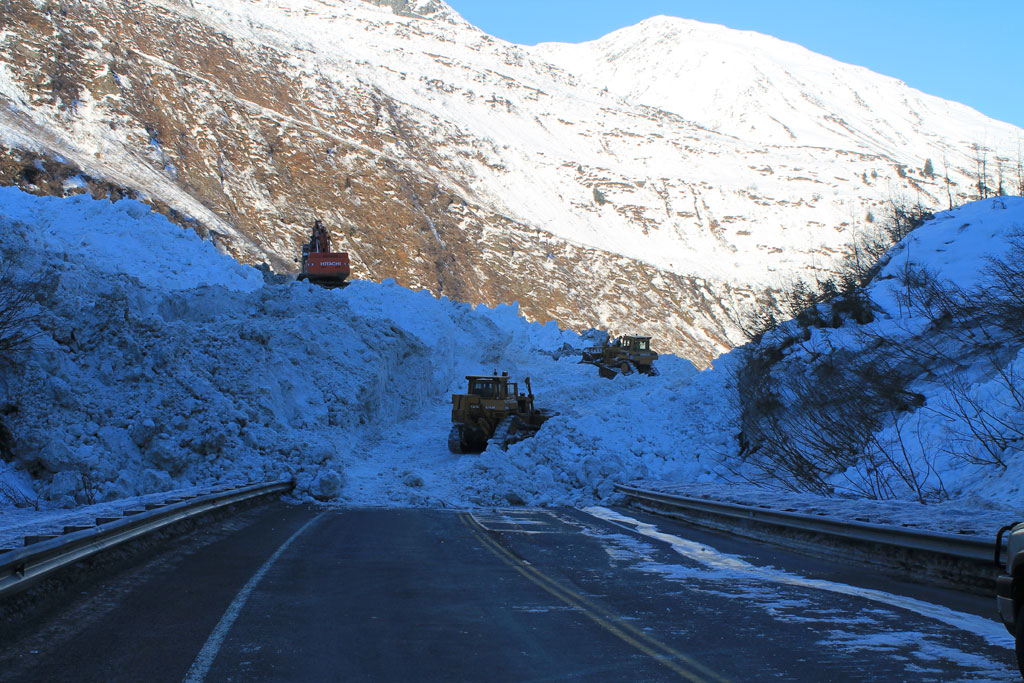
Photo by Alaska DOT&PF staff
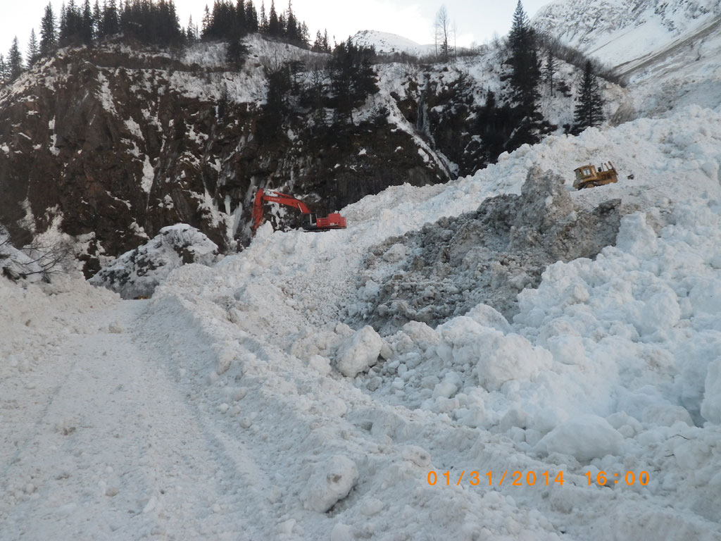
Photo by Alaska DOT&PF staff
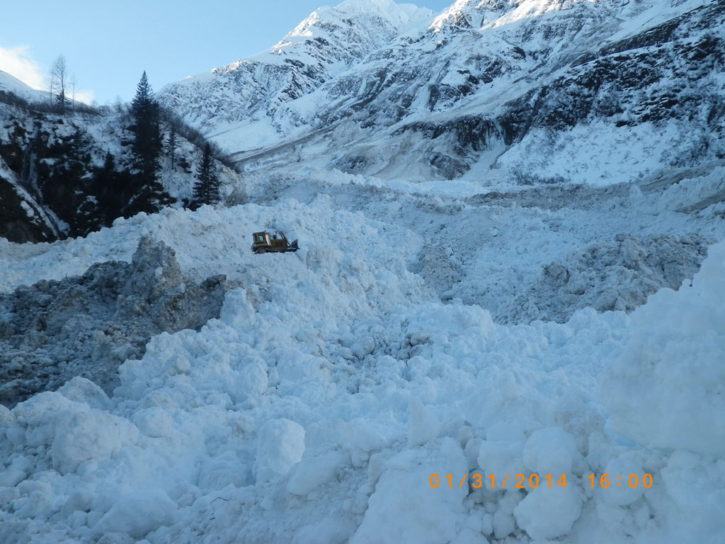
Photo by Alaska DOT&PF staff
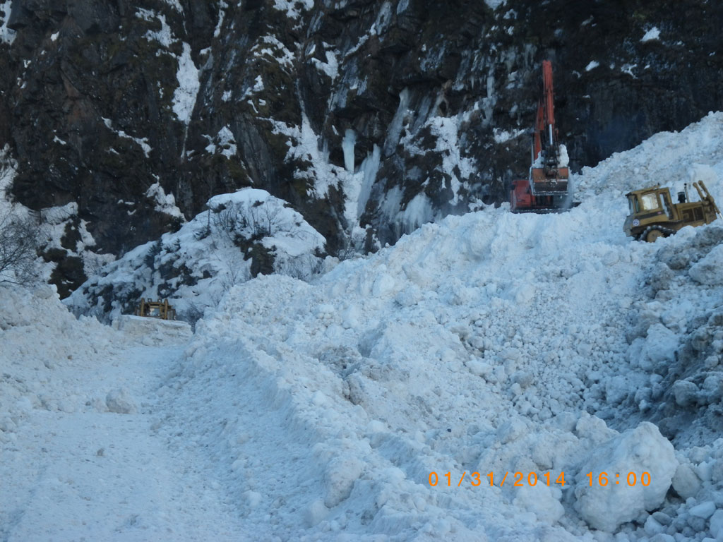
Photo by Alaska DOT&PF staff

Photo by Alaska DOT&PF staff
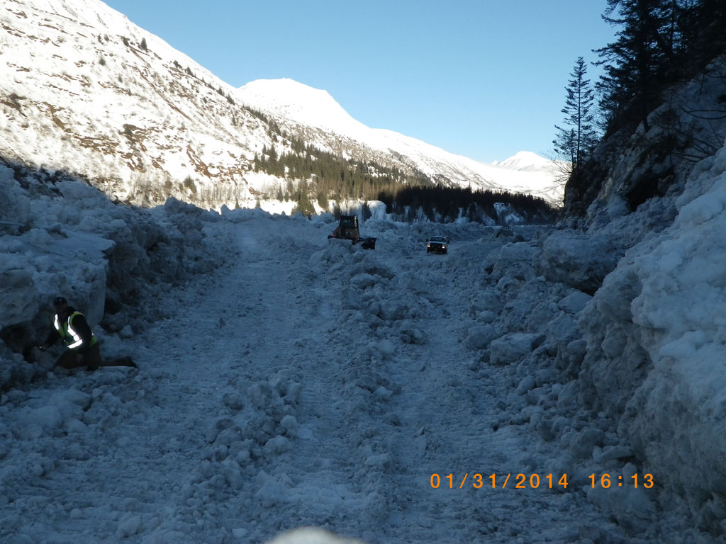
Photo by Alaska DOT&PF staff

Photo by Alaska DOT&PF staff

Photo by Alaska DOT&PF staff
Photos - 1/30/14 (Click image for full size image for download)


Photos - 1/28/14 (Click image for full size image for download)


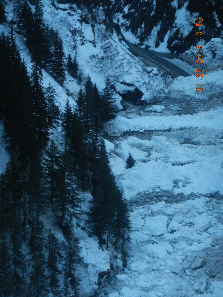
Photos - 1/27/14 (1 of 2) (Click image for full size image for download)

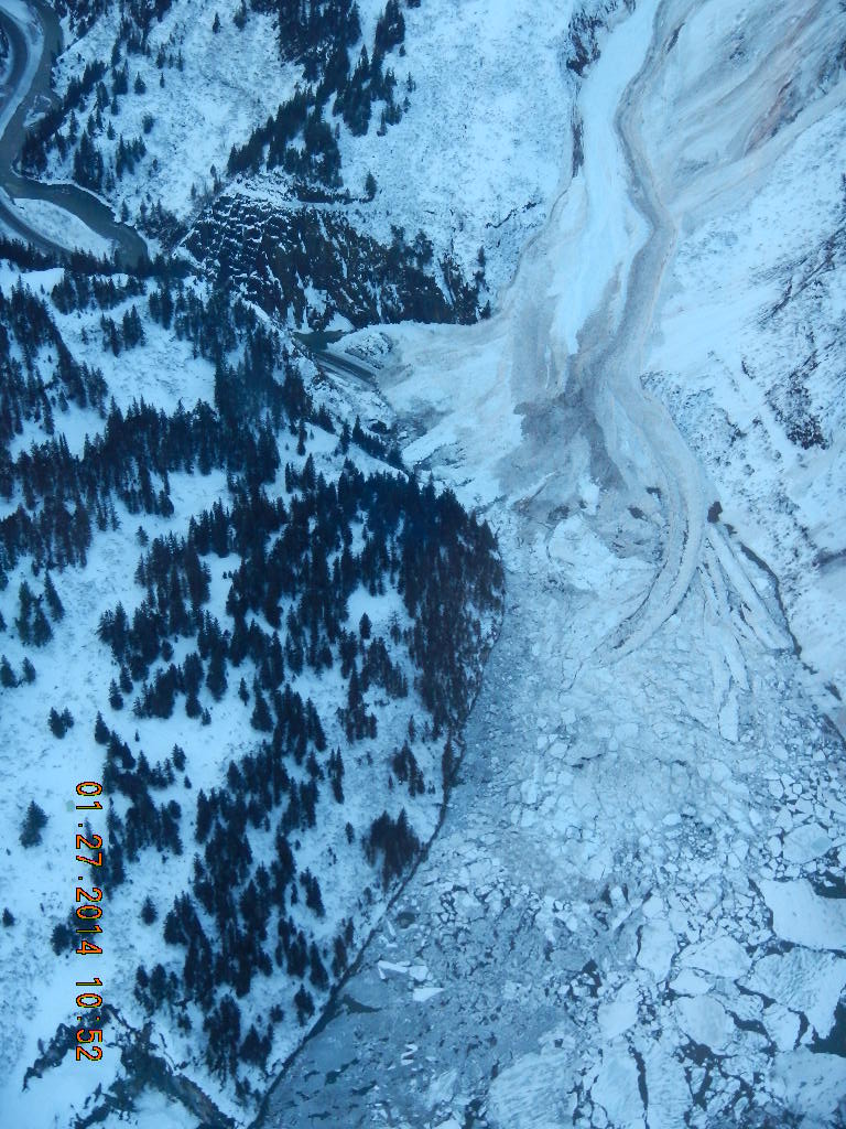

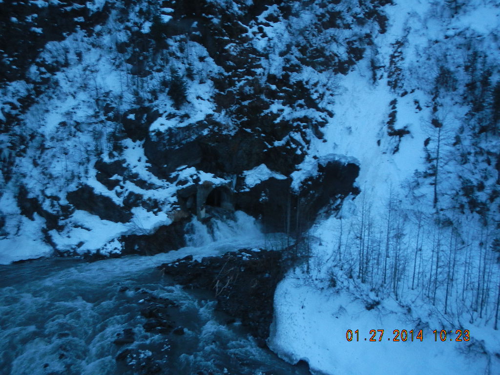


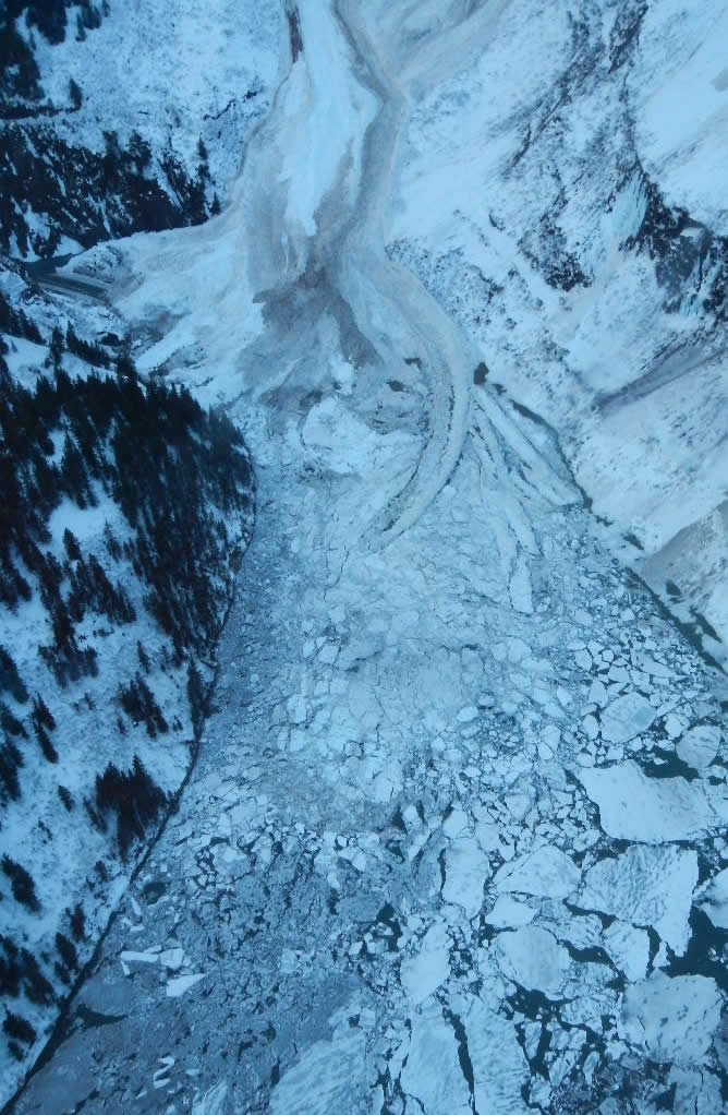
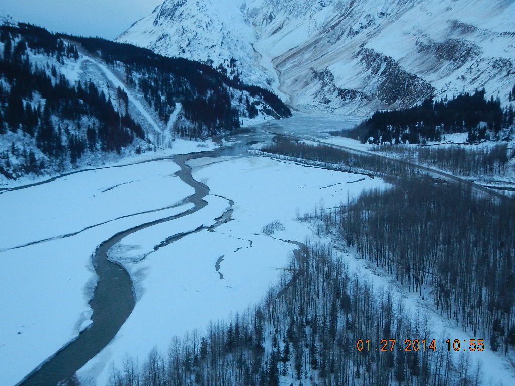
Photos - 1/27/14 (2 of 2) (Click image for full size image for download)


February 5, 2014, 1:30 p.m.
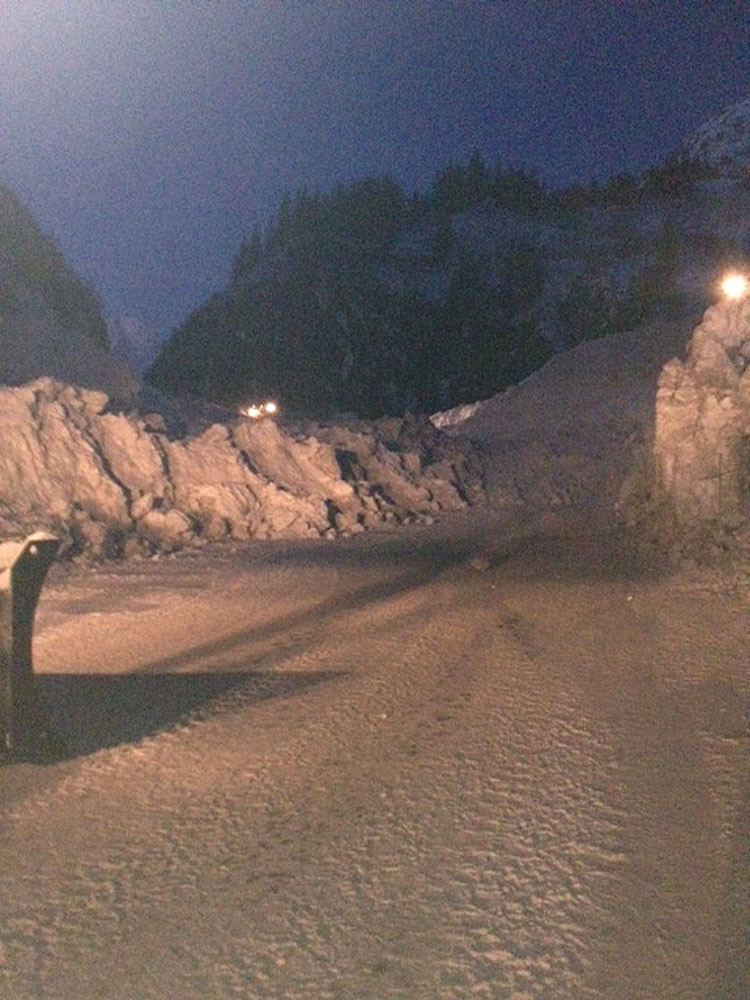
- The Richardson Highway at milepost 12-18 opened at 10:00 a.m. Wednesday, Feb. 5.
- The department has performed multiple stability tests and have determined that the roadway is in good condition and can support both commercial and passenger vehicles.
- The state ferry M/V Aurora will resume its previously posted schedule, available at FerryAlaska.com.
- For further details and updates on road conditions, please visit 511.alaska.gov, dial 5-1-1, or check for 511 updates on Facebook and Twitter.
February 4, 2014, 11:15 a.m.
- The Richardson Highway at milepost 12-18 will open to all traffic Wednesday, Feb. 5, at 3 p.m.
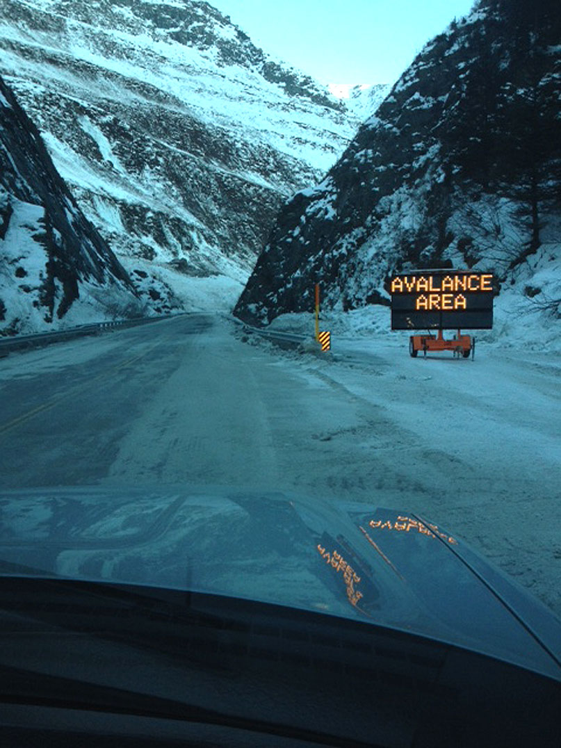
- Motorists are advised to avoid the area until tomorrow’s opening and to respect all posted road closures. The public is not permitted past the avalanche gates.
- The department has performed multiple stability tests and have determined that the roadway is in good condition and can support both commercial and passenger vehicles.
- The state ferry M/V Aurora will resume its previously posted schedule, available at FerryAlaska.com.
- For further details and updates on road conditions, please visit 511.alaska.gov, dial 5-1-1, or check for 511 updates on Facebook and Twitter.
February 2, 2014, 12:00 p.m.
- The highway at MP 12-18 remains closed until further notice.
- ADOT&PF crews continue 24 hour snow removal operations in Keystone Canyon from the south side of the closure.
- The department estimates it will take 3-5 days from the start of operations Friday 1/31 to complete removal of the estimated 100,000-500,000 cubic yards/snow.
- Highway stability tests indicate the road is stable, additional test will continue as work progresses.
- The department will open the highway after it determines the roadway is stable and can safely support commercial and passenger vehicles.
- The M/V Aurora will sail Whittier to Valdez on Monday. The updated schedule is available at FerryAlaska.com
- Road condition updates continue to be posted on 511.alaska.gov
February 1, 2014, 11:15 a.m.
- The highway at MP 12-18 remains closed until further notice
- ADOT&PF crews continue 24 hour snow removal operations in Keystone Canyon from the south side of the closure
- The department estimates it will take 3-5 days to complete removal of the 100,000-500,000 cubic yards/snow
- Highway stability tests indicate the road is stable, additional test will continue as work progresses.
- The department added additional ferry service to Valdez on Monday; updated schedule is at FerryAlaska.com
- Road condition updates continue to be posted on 511.alaska.gov
January 31, 2014, 4:20 p.m.
- The Richardson Highway remains closed at milepost 12-18 until further notice.
- ADOT&PF has begun snow removal at Keystone Canyon. Crews from ADOT&PF and contractor Harris Sand & Gravel mobilized equipment on the south side of the closure Thursday evening and began 24-hour snow removal operations Friday morning.
- The Department has added additional ferry service to Valdez for Monday, Feb. 3. The updated schedule is available at FerryAlaska.com. Travelers may book travel online, at their local terminal or by calling 1-800-642-0066.
- The Department is also performing tests to evaluate highway stability in the area.
- Road condition updates continue to be posted on 511.alaska.gov
January 31, 2014, 11:40 a.m.
- ADOT&PF has begun snow removal at Keystone Canyon. Crews from ADOT&PF and Harris mobilized equipment on the south side of the closure Thursday evening and began 24-hour snow removal operations Friday morning.
- All operators have completed avalanche training and are equipped with avalanche beacons.
- ADOT&PF is also performing tests to evaluate highway stability in the area.
- The highway remains closed at milepost 12-18 until further notice.
- Water on the north side of the slide has now completely receded.
- Road condition updates continue to be posted on 511.alaska.gov
January 30, 2014, 4:30 p.m.
- The Richardson Highway from milepost 12 to 18 remains closed.
- ADOT&PF performed avalanche mitigation work today in Keystone Canyon and as a result has reduced the avalanche risk to moderate.
- Water in the Keystone Canyon area continues to recede.
- Crews have begun clearing ice and snow debris deposited on the highway from the receding waters. This will help the department continue to monitor water that may still be impounded by the avalanche and determine when crews may safely begin excavating the slide debris.
- The Department is also evaluating the condition of the highway to ensure it is stable for traffic and equipment.
- Road condition updates continue to be posted on 511.alaska.gov
January 30, 2014, 9:30 a.m.
- The Richardson Highway milepost 12-18 remains closed until further notice.
- ADOT&PF crews will be performing avalanche mitigation today (1/30) in the Keystone Canyon area.
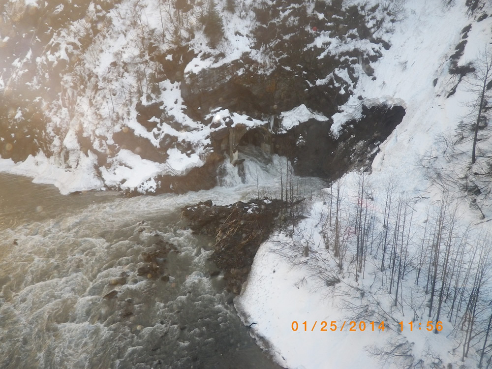
- The water in the flooded area behind the Keystone Canyon avalanche continues to recede. The flow through the highway tunnel has almost stopped and it appears that the river is predominantly back within its banks.
- ADOT&PF crews will begin clearing ice and snow debris from the roadway on the north side of the Keystone Canyon avalanche area. Removal of this debris will allow crews to continue monitoring receding water levels and help them to estimate the amount of impounded water on the roadway.
- Road condition updates will continue to be posted on 511.alaska.gov
January 29, 2014, 4:30 p.m.
- The Department opened milepost 18-42 of the Richardson Highway this afternoon (1/29)
- Milepost 12-18 remains closed until further notice
- ADOT&PF continues to monitor Keystone Canyon, including the water level behind the dam created by the avalanche (still receding) and the stability of the snowpack to determine when it is safe for crews to perform snow removal
- As of this evening, the department plans to perform avalanche mitigation in the Keystone Canyon area on Thursday (1/30)
- Weather is scheduled to have below freezing temperatures this evening with clear skies and no precipitation expected.
- Road condition updates will continue to be posted on 511.alaska.gov
January 29, 2014, 10:30 a.m.
- The water continues to recede on the north side of the Keystone Canyon avalanche and is now approximately 1500 feet from the Lowe River Bridge. This is a reduction of approximately 1000 feet since Monday.
- The temperature did drop below freezing last night both in Valdez and in the upper passes and it is clear so visibility for flying and avalanche control at 39-40 mile is expected to be good. These colder temperatures should also help to reduce the avalanche potential which is going to be verified during today’s avalanche control operations.
- ADOT&PF crews continue to clear slide debris today at milepost 39. The department will make another announcement when the highway can safely be opened from milepost 19-42. This section of highway remains closed until further notice and motorists are advised to avoid the area. The public is not permitted past the avalanche gates.
January 28, 2014, 10:00 a.m.
- Currently it is lightly raining in Valdez and out to the Canyon.
- The City of Valdez has set up a live feed video camera at the southern mouth of the canyon to also watch water flow. The level of the impounded water on the north side of the avalanche is continuing to drop. Currently the water level has receded from the southern bridge approach of the Lowe River Bridge on the north side of the canyon.
- As stated yesterday, the estimated snow on the roadway is approximately 40 feet deep and 1000-1500 feet in length. As of yesterday it was estimated that there was about 10-15 feet of impounded water on the roadway north of the avalanche.
- ADOT&PF crews are continuing to monitor the rate at which the water level is dropping. This is being done to inform the department of the current conditions and also to ensure if there is a sudden release of water (THIS IS NOT EXPECTED) that we can relay this to the City of Valdez so they may forward the information to residents out around 10 mile.
- Once it gets light, the department will begin clearing 39 mile Avalanches from the roadway. There will be spotters present to watch the area while crews are working on this activity.
- Since the water elevation is dropping, the department will review the avalanche site in the canyon to assess the water flows in the river, Tunnel, and along the ditch lines. This will help to better judge the actual height of snow on the roadway and get a better estimate on the quantities of material to move. This will also allow the department to review the bridge abutment and the bridge approach embankments to ensure there is no damage as a result of the water flows.
- ADOT&PF is going to continue to assess the avalanche activity in the upper portion of the pass and determine if we can open the roadway north of approximately milepoint 19 once we have all of the smaller avalanches clear. If the decision is made to open the roadway we will update the 511.alaska.gov website to reflect these conditions. The department will also update the messages on the portable message boards which are located in Tok and Delta.
Press Releases
- February 4: Richardson Highway to Reopen Wednesday Afternoon
- February 1: Governor Surveys Richardson Highway Avalanche
- February 1: Richardson Highway Closure Update: 2/1/14
- January 31: ADOT&PF Begins Snow Removal in Keystone Canyon
- January 30: Richardson Highway Closure Update: 1/30/14
- January 29: ADOT&PF Opens Richardson Highway North of Milepost 18
- January 29: Richardson Highway Closure Update: 1/29/14
- January 28: Richardson Highway Closure Update: 1/28/14
- January 27: Richardson Highway Closure Press Teleconference Availability
- January 24: Richardson Highway Closure Update
- January 24: Richardson Highway Closed Due to Avalanche Activity
Map of Avalanche Area (Click for full size)