
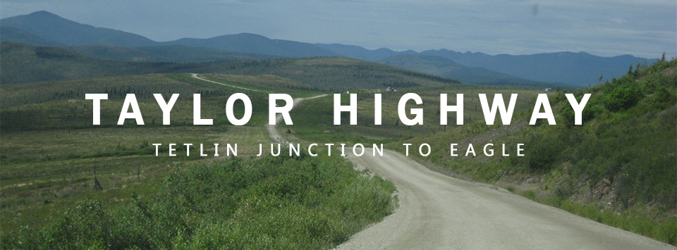
Taylor Highway
Tetlin Junction to Eagle
Constructed between 1947 and 1951, the Taylor Highway (Alaska Route 5) spans 160 miles from Tetlin Junction to Eagle. Built to access the Fortymile Mining District, where gold was discovered in the late 19th century, it remains a route for adventure and history seekers. The road connects to the Top of the World Highway at Jack Wade Junction, offering summer access to Dawson City, Yukon.
Along the route, travelers pass historic mining settlements such as Chicken and Jack Wade, where remnants of Alaska's gold rush can be seen. The road offers stunning views of the Alaska Range and Mentasta Mountains, with chances to spot wildlife like the Fortymile caribou herd. While many original cabins are gone, active mines remain, keeping Alaska's gold rush spirit alive. The Taylor Highway offers a glimpse into Alaska's mining heritage and natural beauty.

Before You Drive…
Road conditions vary with weather and maintenance schedules. The first 60 miles are paved, but the rest is gravel, which can become soft, wet, or rough in places. Check Alaska 511 for current conditions before traveling. Due to its remote location, cell service is unreliable so plan accordingly.
Highway Maintenance
Maintained by the Alaska Department of Transportation and Public Facilities (DOT&PF), maintenance begins in early March, with crews clearing snow and thawing culverts. The road opens in April and remains accessible until mid-October, during which DOT&PF regularly grades gravel sections and repairs rough patches.
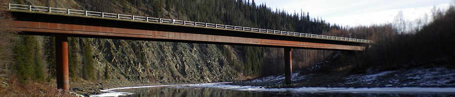
40-Mile Bridge. Photo by Paul Garrett, Alaska DOT&PF
Taylor Highway Fun Facts
Northernmost U.S.-Canada Border Crossing: The highway leads to the Poker Creek–Little Gold Creek Port of Entry, which is the northernmost international border crossing in North America.
Gold Rush Legacy: The highway was built to provide access to the Fortymile Mining District, where gold was discovered as early as 1881.
Chicken, Alaska: One of the towns along the highway is named Chicken because early miners wanted to call it Ptarmigan (after the local bird), but they couldn't spell it.