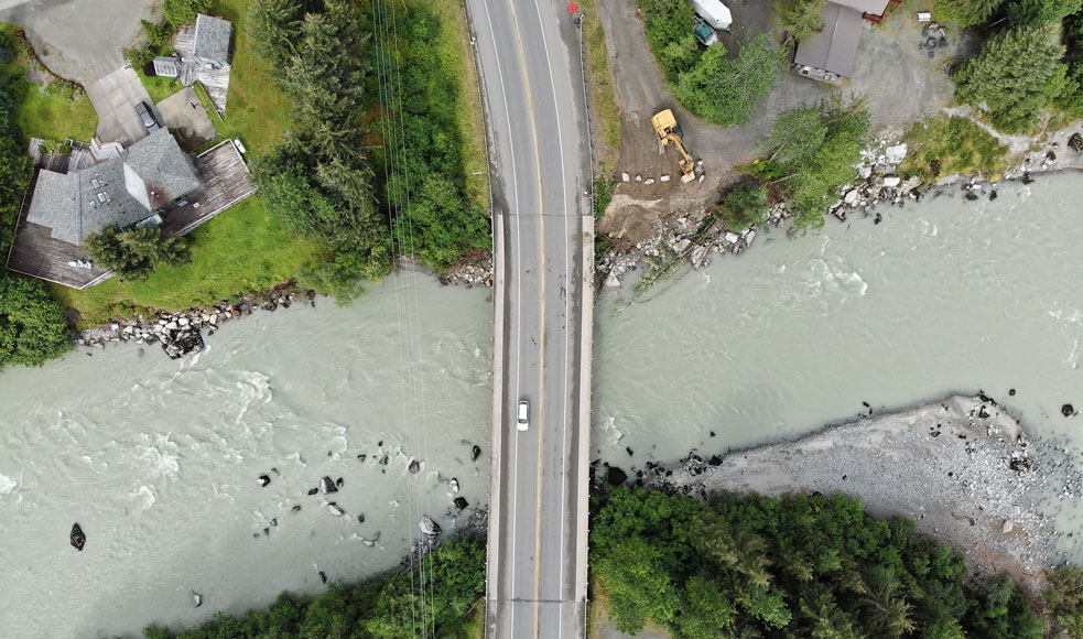
Juneau Glacial Lake Outburst Flood: DOT&PF's Role
Each year, a glacial lake outburst flood (GLOF) from Suicide Basin can send floodwaters down the Mendenhall River. During an active GLOF event, the Alaska Department of Transportation and Public Facilities (DOT&PF) supports the response efforts in two main ways: closing state-owned roads, bridges, and paths to protect the public, and providing drone monitoring as requested, in support of the Unified Command.
Road, Bridge, and Path Closures
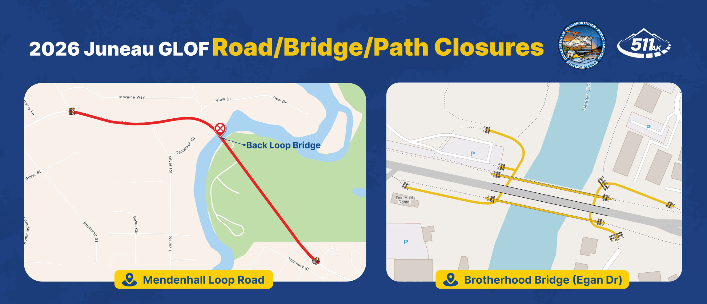
During an active GLOF event, DOT&PF closes specific roads, bridges, and multi-use paths to protect public safety and keep corridors open for emergency responders. Closures apply to motorists and pedestrians. Do not attempt to drive or walk on flooded roads or approach closed bridges. Floodwater moves fast and conditions can change without warning.
Mendenhall Loop Road / Back Loop Bridge
The road and bridge close during the GLOF event (as seen in the graphic above).
Brotherhood Bridge (Egan Dr) Multi-Use Paths
The multi-use pedestrian paths underneath and that crossover the Brotherhood Bridge are closed during the GLOF event. The bridge itself remains open for motorists. Please respect the path closure and stay away.
Drone Monitoring During the GLOF
At the request of the City and Borough of Juneau, DOT&PF provides drone monitoring in support of the Unified Command. DOT&PF has the team, equipment, and capabilities to provide real-time aerial monitoring of the Mendenhall River, the HESCO barriers, and infrastructure. The imagery streams live to the emergency operations center, where the Unified Command uses it to assess barrier performance and make critical decisions throughout the event.
Why we fly
When Suicide Basin releases and the Mendenhall River rises, the most dangerous places to be are near the water and near the barriers. The HESCO barriers are holding back an enormous volume of fast-moving water. Do not walk or congregate along the barriers during active flooding. Drones let crews monitor the most hazardous parts of the flood without placing anyone in harm's way.
What we monitor
- The HESCO barriers, the bridges over the river, and other critical sites, in real time
- Floating trees and debris that could strike a barrier
- Any early sign of failure, so crews can respond quickly
During the 2025 flood, a single tree strike pushed through part of the barrier near the Dimond Park Field House. Continuous aerial monitoring is how a problem like that gets caught fast.
How we do it
Drone crews fly around the clock in shifts, including overnight flights using infrared cameras that see clearly in total darkness. During the record August 2025 flood, DOT&PF monitored the event remotely for a 12-hour stretch without putting personnel in the field. The imagery livestreams straight to the emergency operations center, and all of this data flows directly to the Unified Command.
Temporary Flight Restriction (TFR)
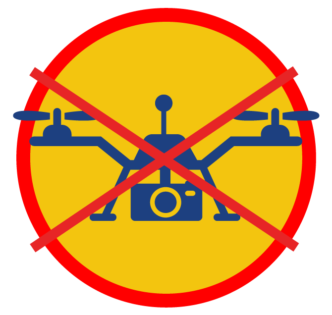
During an active GLOF event, a Temporary Flight Restriction (TFR) may be issued over the flood area. A TFR restricts aircraft, including recreational drones, from operating within a defined airspace for a set period of time. TFRs are issued for safety and operational reasons and are legally binding. Violating a TFR is a federal offense.
Unauthorized drones in the TFR create safety hazards and can shut down emergency monitoring operations. Before flying anywhere near the flood area during a GLOF event, check for active TFRs. If or when a TFR is issued this year, 2026, details including boundaries and duration will be posted publicly. It is the pilot's responsibility to check for NOTAMs before every flight.
Stay Informed
For closure updates, TFR notices, and the latest information during a GLOF event:
- 511.Alaska.Gov for road, bridge, and path closure status
- Follow Alaska DOT&PF on social media for updates and notices
- Visit CBJ Flood Preparedness to sign up for emergency alerts and find additional flood resources from the City and Borough of Juneau
Contact
For questions about state road, bridge, and path closures or DOT&PF drone monitoring operations, contact:
Sonny Mauricio
Public Information Officer, Southcoast Region
(907) 465-4503
sonny.mauricio@alaska.gov
For life-threatening emergencies, call 911. For local flood response questions, emergency alerts, and evacuation information, visit CBJ Flood Preparedness.