
Dalton Highway MP 362-414
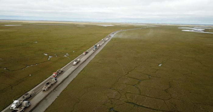 QAP paves the northern section of the project with Deadhorse on the horizon.
Photo taken in August 2020 by Alaska DOT&PF staff
The Alaska Department of Transportation & Public Facilities (DOT&PF) and contractor Quality Asphalt Paving (QAP) are paving the last fifty miles of the Dalton Highway in a two-year project that is being constructed in 2020 and 2021. This is the largest, farthest north highway paving job our department and the State of Alaska have ever undertaken. The purpose of the project is to improve the driving surface of the Dalton Highway as it makes its final stretch across the tundra into Deadhorse and the Prudhoe Bay oil fields.
Corridor History
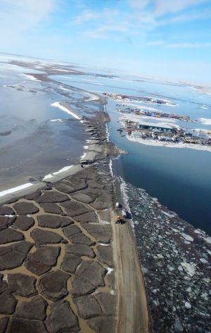
Catastrophic flooding in 2015 shut down the Dalton Highway for 28 days, prompting two state disaster declarations to be issued. Photo taken in May 2015 by Alaska DOT&PF staff
The last fifty miles of the Dalton Highway are built on top of an expansive tundra landscape that spills out of the 126 million-year-old Brooks Mountain Range and heads toward the shores of the Arctic Ocean. This treeless country is covered in snowy darkness, low sun, and Northern Lights much of the year. In the summertime it transforms into rolling grasses, wildflowers, soggy bogs, and wild rivers under constant daylight. The traffic you’ll see on the highway includes a mix of tourists, recreationists, hunters and researchers, but it is dominated by a steady stream of large commercial trucks hauling fuel and supplies to the North Slope oil fields at Prudhoe Bay.
In the spring of 2015, massive overflow and flooding of the Sagavanirktok (Sag) River washed out several sections of the Dalton Highway in the area where this project is being constructed. The floods closed the road for 28 days and prompted two disaster declarations by Alaska’s governor. After the waters receded, a project that was already underway in this section of the highway was modified to raise the road seven to ten feet above the tundra to reduce the possibility of a road under water and an emergency closure during flooding events like 2015.
A delineator is a post or pole, typically marked with high visibility material that delineates or marks the edge of a road. They are used in areas that have low visibility due to snowfall or fog. Delineators are essential for winter travel on the Dalton Highway when high winds and heavy snow create whiteout conditions.
Despite all the efforts to upgrade this section of highway, its gravel surface is still plagued with potholes, ruts, and a rough surface. Maintenance crews stretched thin by years of budget cuts are facing a wetter, warmer climate that is making it increasingly difficult to keep the road in decent shape. Adding to that, the Dalton’s remote location and limited local material sources make it difficult to keep the road in better shape. Fine materials are hard to come by in the gravel that is extracted from the raging Sag River, but they are an essential component of making roads that are well-compacted and strong. The chunky gravel on the Dalton’s surface is quick to break apart into potholes and ruts with few finer materials to bind it together. The drivers of the heavy commercial vehicles making that haul week after week can feel the effects of the poor road condition, and so can the parts and pieces of the big trucks themselves. Enter: pavement.
Project Purpose
The purpose of this project is to improve the driving surface of the last 52 miles of the Dalton Highway in order to better serve the highway’s users and reduce maintenance costs. In addition to new pavement, new delineators will be installed with retroreflective materials that will increase visibility during fog, storms, and blizzards.
Not your average paving job
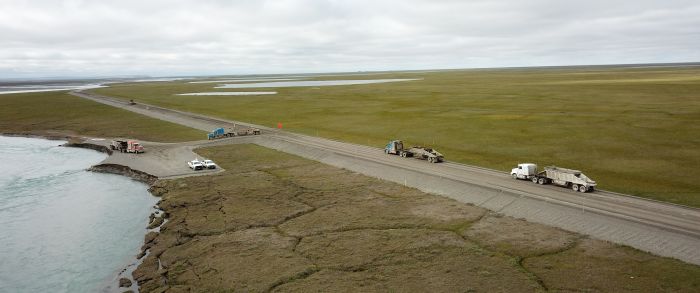 Trucks haul material in preparation for paving. Photo taken August 2020 by Alaska DOT&PF staff
Construction and maintenance on the Dalton Highway is always a logistical challenge. The nearest urban center is in Fairbanks, which is 80 miles south of the start of the Dalton and 494 miles away from its end. There is little cell service or Internet, limited fuel and food services, only a few developed stops along the way, a short summer season, and harsh weather most of the year.
Even the type of traffic the Dalton sees is different. Commercial trucks carrying fuel and supplies for the North Slope oil fields make up most of the traffic and travel in a constant flow year-round. Tourism has also increased, bringing visitors in large busses, passenger cars, bicycles, and even an occasional rickshaw. Various government agencies operate near the highway, including the Bureau of Land Management and researchers from institutions like the University of Alaska Fairbanks.
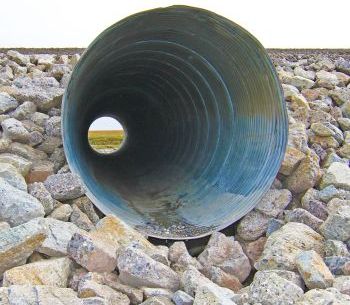
A culvert under the Dalton Highway provides a window to the tundra. Photo taken August 2018 by Alaska DOT&PF staff
Paving creates another set of challenges. The lack of fine materials to get the right mix for the asphalt is as big a problem for paving as it is for gravel maintenance. And then there’s logistics. Contractor QAP transported its asphalt hot plant 850 miles from Anchorage to the northern edge of the project at the beginning of the 2020 season. That’s like driving from Atlanta to New York City on a two-lane highway, and north of Richmond there’s only one restaurant, you’ve got to bring your own gas, and your cell phone doesn’t work—oh, and you’re hauling an asphalt plant. In the 2021 construction season, they may move the plant to the southern end of the project. After the project is constructed, the asphalt plant will be demobilized from the Dalton Highway and head back south. This brings us to the next phase.
A new maintenance challenge
The truth is that we’re not entirely sure what’s going to happen to this pavement after construction is complete. Will we see a lot of ground-shifting and settling that will cause will dips, cracks, and jacking? Will we see potholes develop at a high rate? Will the materials under the road hold up and make for relatively smooth pavement over time? We don’t know for sure because we’ve never paved a highway this far north. But there are some things we do know.
Based on modeling done by our materials lab, we expect that the ground beneath the road will remain cold, even with the new black pavement that will absorb more heat than the gravel. Keeping the permafrost frozen is a big part of ensuring the ground is stable and the pavement holds up. Our team isn’t just modeling based on current climate, they are also taking into consideration climate change projections.
In addition to material and climate modeling, we also have a ton of experience maintaining roads all over a state more diverse in climate that some continents, we have a highly specialized team of engineers and maintenance professionals who will be studying the pavement closely, and we have a variety of tools to deal with whatever comes our way.
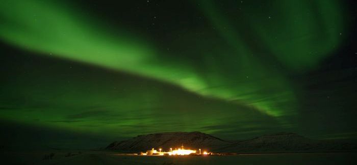 Northern Region DOT&PF Sag River Camp at Dalton mile 305 under the Northern Lights.
Photo taken November 2017 by Alaska DOT&PF staff
DOT&PF maintenance crews have to patch pavement on other spots along the Dalton—the whole road is a mix of gravel, pavement, and high float (which is sort of a combination of both). The maintenance crews currently only patch the road with hot mix asphalt (the kind you get out of an asphalt plant) up to mile 209. To get that far with the mix still as hot as it needs to be, the belly dumps that drive it north have been custom-insulated to keep in the heat. Past mile 209, though? It’s just too far away from the asphalt plant to stay hot. They’ll need a different solution.
DOT&PF maintenance uses cold mix asphalt to patch north of mile 209, but the results haven’t been spectacular. The patches only last a matter of weeks. Recently DOT&PF purchased an asphalt patching machine that we have used with great success at patching potholes in our high float sections. We also have a tanker that can keep oil hot all the way to Deadhorse at the end of the road. This allows us the possibility of using a pug mill—a portable asphalt mixer that can produce hot mix asphalt in smaller quantities. We have successfully used a pug mill for years at our Tazlina maintenance station, located at the junction of the Glenn and Richardson Highways much farther south.
We are always keeping up with new technologies and equipment, and, out of necessity if nothing else, are always open to trying new techniques. Although we don’t know exactly what the asphalt from this project will do quite yet, we’re confident in our ability to adapt to the solution that works.
A long road to now
The history of the Dalton Highway and its construction to support the Trans-Alaska Pipeline in the 1970s was tumultuous from the beginning. You can read more about that here. But there’s no doubt that one of the most dramatic events in the highway’s history was the 2015 flooding that washed away much of this northern section of the Dalton down to the tundra. In the following five years, it was entirely rebuilt and raised into a new road, with pavement as the final touch. We’re looking forward to what the next fifty years may bring to this one-of-a-kind northern highway.
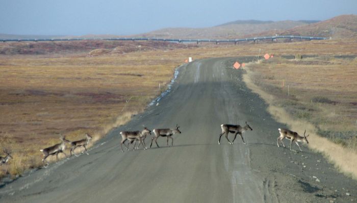 Caribou cross the Dalton Highway just north of the Brooks Range. Photo taken in 2010 by Alaska DOT&PF staff
Project Information
For more information contact:
Madrilena Bradley
DOT&PF Project Engineer
2301 Peger Rd Fairbanks, AK 99709-5316
![]() (907) 322-5953 or
(907) 322-5953 or
![]() madrilena.bradley@alaska.gov
madrilena.bradley@alaska.gov
PLEASE NOTE: Adobe Acrobat PDF files require a free viewer available directly from Adobe.