Contact: Greg Lockwood, 907.465.2393, Greg.Lockwood@alaska.gov
Shelter Cove Road is Now Open for Public Travel
Travelers are encouraged to check conditions at 511.alaska.gov before traveling.
(Ketchikan, Alaska) —The Alaska Department of Transportation and Public Facilities (DOT&PF) is pleased to announce the opening of a new roadway near Ketchikan. The project delivers 7.29 miles of new 14-foot-wide single-lane gravel road with intervisible turnouts, improving access for the surrounding community.
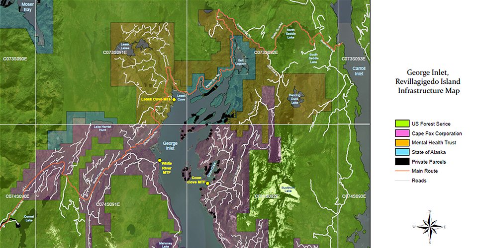
The new roadway begins at the gate near the end of White River Road, extending along the northern end of George Inlet, and connects to the U.S. Forest Service’s Shelter Cove Road system near Salt Creek. With this connection, roadway travel is now available to Shelter Cove and Carroll Inlet.
Project work included:
- Installation of more than 200 culverts
- Replacement of 5 bridges
- Placement of a six-inch crushed rock surface course
A map of the road and surrounding area can be viewed below.
Before traveling on Shelter Cove Road, visit 511.alaska.gov or call 511 for the latest conditions.
# # #
The Alaska Department of Transportation and Public Facilities oversees 237 airports, 9 ferries serving 35 communities along 3,500 marine miles, over 5,600 miles of highway and 839 public facilities throughout the state of Alaska. The mission of the department is to “Keep Alaska Moving.”

