
HSIP: Airport Way/Steese Expressway Reconstruction
Project No. 0002(385)/NFHWY00245
What to expect in Summer 2024
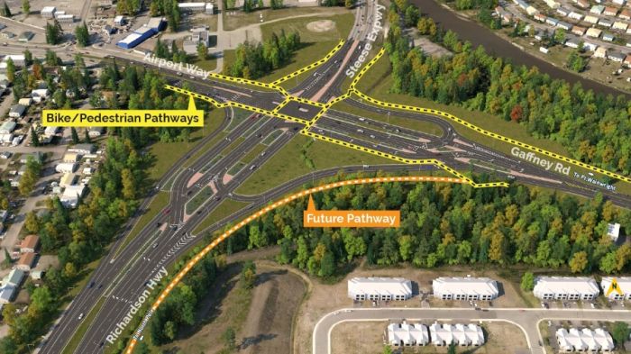
We’ll have new signs and some signal updates we need to make, so you’ll see us out and about at the intersection periodically. The biggest change being some overhead signs that we’ll be installing on the Richardson Highway, you’ll see them as you’re coming towards the intersection from North Pole. We’ll also be paving the bike path along the Richardson Highway that’ll connect to Badger Road, in coordination with the Richardson Highway MP 359 Railroad Grade Separated Facility project.
What will be different about the new intersection?
The main difference will be how drivers take left turns. You will either turn left before or after the intersection depending on which direction you’re coming from. We separated lefts from the core intersection to improve safety. (How does separating left turn make it safer? Jump to this section for more.)
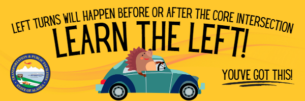
Learn the left! (How exactly are left turns different?)
Click on the ribbons below to learn about what the left turn you take most often will look like.
You will turn left BEFORE the core intersection:
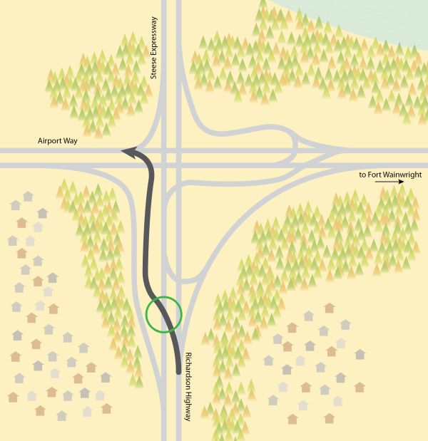
Watch for overhead signs to tell you what lane to be in. You will pass through two signals, one when you cross Airport Way traffic and one while turning onto the Richardson Highway. In most cases, you will only have to stop at one signal because the timing will be coordinated.
This video shows what it will look like to make this left turn as a driver:
You will turn left BEFORE the core intersection:
Watch for overhead signs to tell you what lane to be in. You will pass through two signals, one when you cross Airport Way traffic and one while turning onto the Richardson Highway. In most cases, you will only have to stop at one signal because the timing will be coordinated.
This video shows what it will look like to make this left turn as a driver:
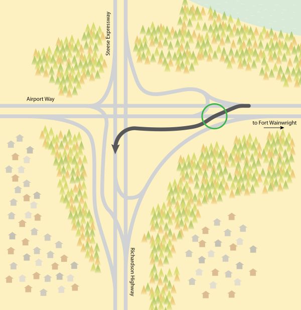
You will turn AFTER the core intersection:
Watch for signs and lane markings to tell you what lane to be in. You will drive through the core intersection first, then cross oncoming traffic and swing back around to merge onto the Steese Expressway. You will pass through two signals, one at the core intersection and one when you cross oncoming Gaffney Road traffic from Ft. Wainwright.
This video shows what it will look like to make this left turn as a driver:
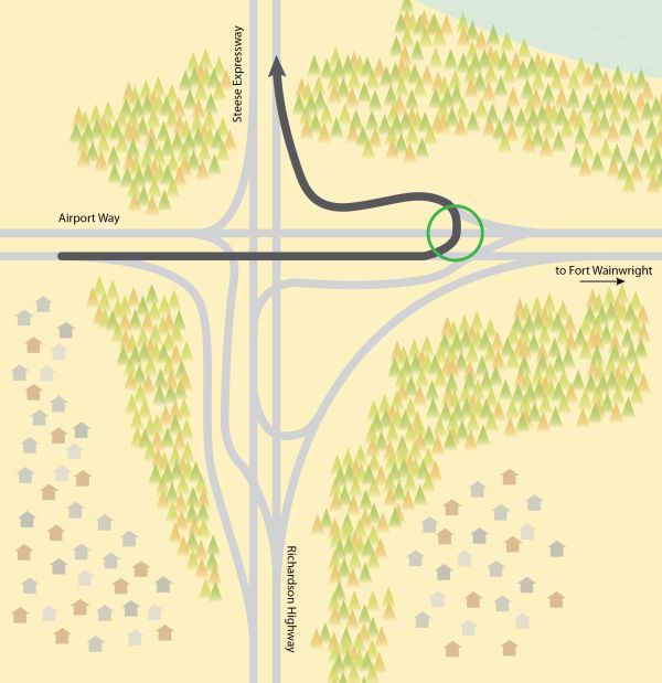
You will turn AFTER the core intersection:
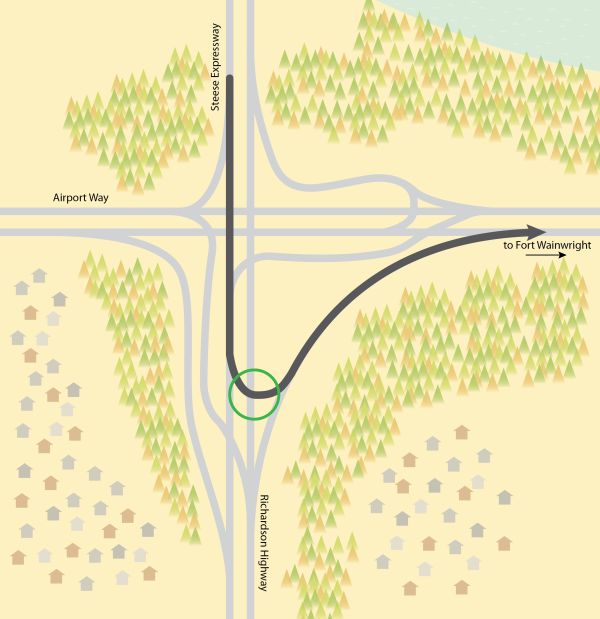
Watch for signs and lane markings to tell you what lane to be in. You will drive through the core intersection first, then cross oncoming traffic and swing back around to merge onto Gaffney Road leading into Fort Wainwright. You will pass through two signals, one at the core intersection and one when you cross oncoming Richardson Highway traffic.
This video shows what it will look like to make this left turn as a driver:
Why change the left turns?
Most crashes in traditional four-leg intersections happen when drivers are turning, especially when they are making left turns. There are lots of opportunities for conflict when making left-hand turns including oncoming traffic, oncoming traffic turning right into your lane, pedestrians crossing, and drivers pulling up behind you. There are a lot of things to pay attention to!
By separating the left turns from the main intersection, we are separating those conflict points. You have fewer things competing for your attention at once and can move through the intersection more safely.
Separating the left turns also allows traffic to move through the intersection more efficiently, reducing your wait times compared to the old intersection. (Fun fact: this intersection is the second busiest in Fairbanks at 35,000 vehicles per day.)
How will I know where to go?
Signs, signals, striping, and landscaped medians will help you get where you need to go. The best thing you can do to prepare is learn the left.
There will also be plenty of street lighting to keep things visible during the dark months.
Will there be traffic signals? Yes!
Left-hand turns will always have a signal while crossing traffic. The signals will be timed so that you rarely have to stop at more than one.
The power at this intersection will be equipped with a battery back-up that runs off piped natural gas to keep the signals and lights working during an outage.
What will happen when the power goes out?
We have industrial batteries that will keep the intersection going even through a power outage! There is also a generator hookup that we can utilize in case of long duration outages, so the intersection can stay running at all times.
In the summer of 2024, we also have plans to install a natural gas powered generator to ensure the traffic signals stay active at all times!
What will happen when it snows?
This intersection is the number one, first priority intersection in the Fairbanks area. This means it will always be the first spot our crews hit when a storm rolls in. Our Fairbanks maintenance team already has a plan in place for how to plow and clean this intersection that they developed during the design process to make sure their needs were incorporated.
There are more lanes to maintain, so it will take longer to plow and clean than the previous intersection. This is true about almost all our upgrade and improvement projects. This extra time will have a bigger impact on lower priority roads than it will on this intersection, since this will be the first one we plow after a storm. With this in mind, the design team added wide shoulders and extra snow storage in the area to help mitigate these impacts.
We recognize that traffic striping is often covered by snow through in the winter. Signs (including some overhead signs) and medians will help guide you even if you can’t see the stripes.
How will pedestrians get through the intersection?
Pedestrians will be able to navigate this intersection more safely and quickly, too! There will be fewer lanes of traffic to cross at a time and crossing times should be faster. This intersection will connect with a bike path that we are planning to construct that will eventually connect North Pole to Fairbanks, which means we expect pedestrian crossings at this intersection to increase in the years to come.
This graphic shows how pedestrians will navigate the new intersection.
Why didn’t you build an overpass?
Initially we looked into building an overpass but an overpass would have been so expensive ($40-$50 million) that we weren’t sure we would be able to fund it for many years, if at all. This project is being funded by the Federal Highway Safety Improvement Program, which has a limited budget. (This is not the same funding program that will pay for the project at the Steese/Johansen intersection, for example, so this project is under a different set of funding constraints.) The new intersection costs about a third of an overpass—about $15 million.
Even better news, when we modeled this design and how it would move traffic through the intersection compared to the overpass, we realized that this design would function better than any other option. Unlike an overpass, it doesn’t shut down left turns onto 10th Avenue and it is better for the nearby intersections because it meters the traffic better. An overpass design would have spilled traffic into the adjacent intersections at a high rate, causing them to be overwhelmed. With the overpass design, you would have been able to get through this intersection quickly, only to wait much longer at the intersections around it.
Questions?
If you have questions about how to navigate the intersection, please contact the Northern Region Information Officer, John Perreault, at john.perreault@alaska.gov or 907-451-5311.
If you have questions about construction, please contact Project Engineer, Sean Berg, at sean.berg@alaska.gov or 907-451-1679.
This project was developed in cooperation with the Alaska Division of the Federal Highway Administration. While developing this design concept we also worked closely with Ft. Wainwright, the City of Fairbanks, Emergency Services personnel, the trucking industry, and other community interest groups in Fairbanks to be sure their concerns were addressed.
2021 Project Documents
- Location and Vicinity Map
- Continuous Flow Intersection Median U-Turn Intersection (CFI-MUT) Fact Sheet
- Proposed Solution: CFI-MUT
- 2021 Frequently Asked Questions
Past Public Involvement Documents
- 2020 Public Meeting Information
- 2020 Project Overview
- 2020 Design Alternatives
- 2020 Project FAQs
- 2018-2019 Public Outreach Information
- 2018-2019 Design Concept Diverging Diamond Interchange
Use DOT&PF’s Alaska Project Exchange tools to learn more about all of DOT&PF’s active construction projects statewide!
Want to know how construction will impact road traffic? Visit 511.alaska.gov
Want to dig into the details about projects across the state? Visit dot.alaska.gov/construction
For more information contact:
Sean Berg
Project Engineer
sean.berg@alaska.gov
(907) 451-1679
For individuals requiring TTY communications, please contact Alaska Relay at 7-1-1 or 1-800-770-8973.
Alaska Department of
Transportation & Public Facilities
2301 Peger Road
Fairbanks, AK 99709
DOT&PF complies with the following Executive Orders (EO): EO 11990 Notice of Wetland Involvement, EO 12898 Environmental Justice, EO 11593 Protection and Enhancement of Cultural Resources, EO 11988 Floodplain Management, EO 13007 Indian Sacred Sites, EO 13175 Consultation with Indian Tribal Governments, and EO 13112 Invasive Species, as amended by EO 13751.
PLEASE NOTE: Adobe Acrobat PDF files require a free viewer available directly from Adobe.